IMAGES TAKEN NEAR TO
Elsham Place, NEWARK, NG24 5BD
Introduction
This page details the photographs taken nearby to Elsham Place, NG24 5BD by members of the Geograph project.
The Geograph project started in 2005 with the aim of publishing, organising and preserving representative images for every square kilometre of Great Britain, Ireland and the Isle of Man.

There are currently over 7.5m images from over14,400 individuals and you can help contribute to the project by visiting https://www.geograph.org.uk
Image Map
Images are licensed for reuse under creativecommons.org/licenses/by-sa/2.0
Notes
- Clicking on the map will re-center to the selected point.
- The higher the marker number, the further away the image location is from the centre of the postcode.
Image Listing (14 Images Found)
Images are licensed for reuse under creativecommons.org/licenses/by-sa/2.0
Image
Details
Distance
1
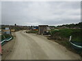
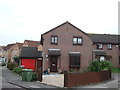
New development, Fernwood
Fernwood is growing rapidly with development ongoing at three separate sites.
Image: © Jonathan Thacker
Taken: 12 May 2023
0.15 miles
2
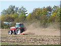
Harrowing
A tractor and power harrow at work off Spring Lane
Image: © Richard Croft
Taken: 30 Sep 2011
0.18 miles
3
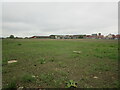
Open space, Fernwood
Chuter Ede Primary School in the distance.
Image: © Jonathan Thacker
Taken: 12 May 2023
0.18 miles
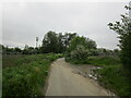
4
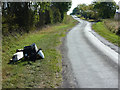
Spring Lane
Flytipped rubbish on Spring Lane
Image: © Richard Croft
Taken: 30 Sep 2011
0.19 miles
6
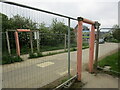
Pedestrian crossing, Hollowdyke Lane, Fernwood
Hollowdyke Lane was once a through route (I learnt to drive here) but this ection is now reduced to a footpath and a redundant developer's access.
Image: © Jonathan Thacker
Taken: 12 May 2023
0.20 miles
7
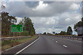
A1 bypassing Newark
Newark has dropped off the mileage signs, but Lincoln and Sleaford have appeared. These are both well off the A1 and reached via the exit just north of Newark.
Image: © Robin Webster
Taken: 7 Oct 2011
0.20 miles
9
Hollowdyke Lane
Once a through road now truncated by the develoment of Fernwood.
Image: © Jonathan Thacker
Taken: 12 May 2023
0.21 miles
10
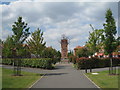
Rubys Walk
The Clock Tower is a point de vue in a piece of formal planning which is untypical of Fernwood.
Image: © Jonathan Thacker
Taken: 5 Aug 2011
0.22 miles