IMAGES TAKEN NEAR TO
Grange Road, NEWARK, NG24 4PL
Introduction
This page details the photographs taken nearby to Grange Road, NG24 4PL by members of the Geograph project.
The Geograph project started in 2005 with the aim of publishing, organising and preserving representative images for every square kilometre of Great Britain, Ireland and the Isle of Man.

There are currently over 7.5m images from over14,400 individuals and you can help contribute to the project by visiting https://www.geograph.org.uk
Image Map
Images are licensed for reuse under creativecommons.org/licenses/by-sa/2.0
Notes
- Clicking on the map will re-center to the selected point.
- The higher the marker number, the further away the image location is from the centre of the postcode.
Image Listing (20 Images Found)
Images are licensed for reuse under creativecommons.org/licenses/by-sa/2.0
Image
Details
Distance
1
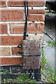
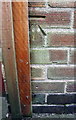
Benchmark on #3-5 Fairfax Avenue
Ordnance Survey cut mark benchmark described on the Bench Mark Database at http://www.bench-marks.org.uk/bm75316
Image: © Roger Templeman
Taken: 2 May 2016
0.04 miles
2
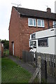
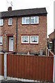
#3-5 Fairfax Avenue
There is an OS benchmark Image on the side of the house at its front corner
Image: © Roger Templeman
Taken: 2 May 2016
0.04 miles
3
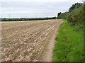
Bridleway near Hawton Ville
The hedge marks the backs of gardens of houses along Grange Road.
Image: © Alan Murray-Rust
Taken: 4 Sep 2012
0.06 miles
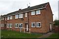
4
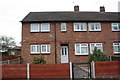
Philip Road houses
There is an OS benchmark Image on the front left hand corner of the houses, just inside the wooden gate
Image: © Roger Templeman
Taken: 2 May 2016
0.09 miles
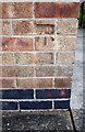
5
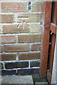
Benchmark on #55 Philip Road
Ordnance Survey cut mark benchmark described on the Bench Mark Database at http://www.bench-marks.org.uk/bm75313
Image: © Roger Templeman
Taken: 2 May 2016
0.09 miles
6
Nos. 97 and 99 Philip Road
There is an OS benchmark Image on the right front corner of the house between a large plant pot and abutting fence
Image: © Roger Templeman
Taken: 2 May 2016
0.12 miles
7
Benchmark on #97 Philip Road
Ordnance Survey cut mark benchmark described on the Bench Mark Database at http://www.bench-marks.org.uk/bm75314
Image: © Roger Templeman
Taken: 2 May 2016
0.12 miles
8
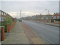
Grange Road
View east along the street which marks the southern boundary of Newark.
Image: © Trevor Rickard
Taken: 29 Jan 2012
0.12 miles
9
Block of flats on Grange Road
There is an OS benchmark Image on the near corner of the block, left hand face
Image: © Roger Templeman
Taken: 2 May 2016
0.15 miles
10
Benchmark on #82/84 Grange Road
Ordnance Survey cut mark benchmark described on the Bench Mark Database at http://www.bench-marks.org.uk/bm75317
Image: © Roger Templeman
Taken: 2 May 2016
0.15 miles