IMAGES TAKEN NEAR TO
Staunton Road, NEWARK, NG24 4EZ
Introduction
This page details the photographs taken nearby to Staunton Road, NG24 4EZ by members of the Geograph project.
The Geograph project started in 2005 with the aim of publishing, organising and preserving representative images for every square kilometre of Great Britain, Ireland and the Isle of Man.

There are currently over 7.5m images from over14,400 individuals and you can help contribute to the project by visiting https://www.geograph.org.uk
Image Map
Images are licensed for reuse under creativecommons.org/licenses/by-sa/2.0
Notes
- Clicking on the map will re-center to the selected point.
- The higher the marker number, the further away the image location is from the centre of the postcode.
Image Listing (26 Images Found)
Images are licensed for reuse under creativecommons.org/licenses/by-sa/2.0
Image
Details
Distance
2
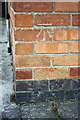
Benchmark on #45 Carlton Road
Ordnance Survey cut mark benchmark described on the Bench Mark Database at http://www.bench-marks.org.uk/bm75323
Image: © Roger Templeman
Taken: 2 May 2016
0.08 miles
3
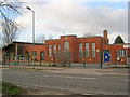
Oliver Quibell Community Infant School
On the west side of Bowbridge Road and, I assume, named after the famous industrialist and former mayor of Newark.
http://www.oliverquibell.co.uk/
Image: © Trevor Rickard
Taken: 22 Jan 2012
0.09 miles
4
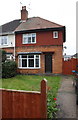
#45 Carlton Road and #9 Cleveland Square
There is an OS benchmark Image on the near corner, right hand face, of the left hand house
Image: © Roger Templeman
Taken: 2 May 2016
0.09 miles
5
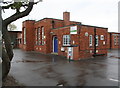
Hawtonville Children's Centre, Bowbridge Road
Image: © phil Richards
Taken: 2 May 2016
0.10 miles
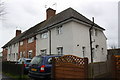
8
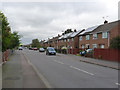
Bailey Road
Part of the post-war section of the large Hawtonville estate to the south of the town.
Image: © Alan Murray-Rust
Taken: 4 Sep 2012
0.18 miles
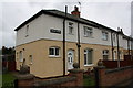
9
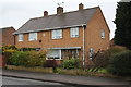
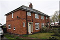
Nos. 2A/2B Bailey Road
There is an OS benchmark Image on the near corner, right hand face, of the right hand face
Image: © Roger Templeman
Taken: 2 May 2016
0.18 miles
10
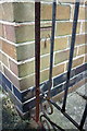
Benchmark on #2A Bailey Road
Ordnance Survey cut mark benchmark described on the Bench Mark Database at http://www.bench-marks.org.uk/bm75322
Image: © Roger Templeman
Taken: 2 May 2016
0.18 miles