
IMAGES TAKEN NEAR TO
Warwick Road, NEWARK, NG24 3QE
Introduction
This page details the photographs taken nearby to Warwick Road, NG24 3QE by members of the Geograph project.
The Geograph project started in 2005 with the aim of publishing, organising and preserving representative images for every square kilometre of Great Britain, Ireland and the Isle of Man.

There are currently over 7.5m images from over14,400 individuals and you can help contribute to the project by visiting https://www.geograph.org.uk
Image Map
Images are licensed for reuse under creativecommons.org/licenses/by-sa/2.0
Notes
- Clicking on the map will re-center to the selected point.
- The higher the marker number, the further away the image location is from the centre of the postcode.
Image Listing (75 Images Found)
Images are licensed for reuse under creativecommons.org/licenses/by-sa/2.0
Image
Details
Distance
1
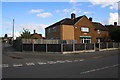
Junction in Warwick Road
The house at the corner (#64) appears to have been extended
Image: © phil Richards
Taken: 2 Oct 2016
0.09 miles
2
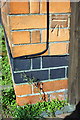
Benchmark on #197 London Road
Ordnance Survey cut mark benchmark described on the Bench Mark Database at http://www.bench-marks.org.uk/bm79500
Image: © Roger Templeman
Taken: 2 Oct 2016
0.12 miles
3
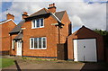
#197 London Road
There is an OS benchmark Image on the near corner, beside the wooden gate, of the former police station
Image: © Roger Templeman
Taken: 2 Oct 2016
0.12 miles
4
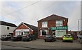
Pharmacy and Chinese Takeaway, Main Street, Balderton
Image: © Jonathan Thacker
Taken: 28 Jan 2020
0.13 miles
5
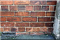
Benchmark on #35 Main Street
Ordnance Survey cut mark benchmark described on the Bench Mark Database at http://www.bench-marks.org.uk/bm79499
Image: © Roger Templeman
Taken: 2 Oct 2016
0.13 miles
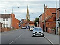
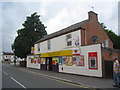
8

Junction of Main Street and Warwick Road
There is an OS benchmark Image on the house at the corner, on the blank face about 2ft. left of its junction with the light brown wall
Image: © Roger Templeman
Taken: 2 Oct 2016
0.13 miles
9
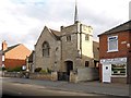
Balderton Methodist Church
Built 1899-1907, Balderton Methodist Church is a Grade II Listed Building (English Heritage ID:242637 http://www.britishlistedbuildings.co.uk/en-242637-methodist-church-balderton-nottinghamshi British Listed Buildings)
Image: © David Dixon
Taken: 8 Sep 2013
0.14 miles
10
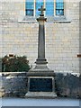
Balderton War Memorial
The war memorial outside Image
The plaque on the base reads "To the undying memory of the men of Balderton who at the call of king and country left all that was dear to them, endured hardness, faced perils and many of whom passed out of the sight of men by the path of duty and self-sacrifice".
Image: © David Dixon
Taken: 8 Sep 2013
0.14 miles