IMAGES TAKEN NEAR TO
Mulberry Close, NEWARK, NG24 2UB
Introduction
This page details the photographs taken nearby to Mulberry Close, NG24 2UB by members of the Geograph project.
The Geograph project started in 2005 with the aim of publishing, organising and preserving representative images for every square kilometre of Great Britain, Ireland and the Isle of Man.

There are currently over 7.5m images from over14,400 individuals and you can help contribute to the project by visiting https://www.geograph.org.uk
Image Map
Images are licensed for reuse under creativecommons.org/licenses/by-sa/2.0
Notes
- Clicking on the map will re-center to the selected point.
- The higher the marker number, the further away the image location is from the centre of the postcode.
Image Listing (20 Images Found)
Images are licensed for reuse under creativecommons.org/licenses/by-sa/2.0
Image
Details
Distance
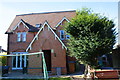
1
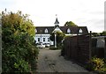
Former stable block, Hillside
Hillside was a substantial house built by William Newton in 1875. For something of its history see https://legacy.newarkadvertiser.co.uk/leisure/tourism/history/TimWarner/warner81.asp
The stable block is now converted to housing.
Image: © Jonathan Thacker
Taken: 7 Sep 2019
0.08 miles
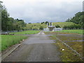
2
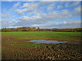
Autumn sown crop and Beacon Heights
Image: © Jonathan Thacker
Taken: 2 Jan 2021
0.10 miles
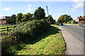
4
#158 Beacon Hill Road, extended east end
Image: © phil Richards
Taken: 3 Oct 2016
0.14 miles
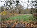
7
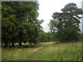
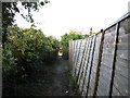
Abandoned field off Clay Lane
Many of the fields at the western end of Clay Lane have been abandoned. This field has a park-like feel to it and I wonder if it belonged to Beacon Hill House. South Lodge which is just to the left of this picture presumably was the South Lodge to the Beacon Hill estate.
Image: © Jonathan Thacker
Taken: 13 Aug 2010
0.16 miles
8
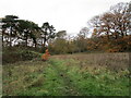
Abandoned field off Clay Lane
Zoned for future housing.
Image: © Jonathan Thacker
Taken: 17 Nov 2020
0.16 miles
9
Trees and abandoned field off Clay Lane
This land is zoned for future housing.
Image: © Jonathan Thacker
Taken: 17 Nov 2020
0.17 miles