IMAGES TAKEN NEAR TO
Back Lane, NEWARK, NG24 2SE
Introduction
This page details the photographs taken nearby to Back Lane, NG24 2SE by members of the Geograph project.
The Geograph project started in 2005 with the aim of publishing, organising and preserving representative images for every square kilometre of Great Britain, Ireland and the Isle of Man.

There are currently over 7.5m images from over14,400 individuals and you can help contribute to the project by visiting https://www.geograph.org.uk
Image Map
Images are licensed for reuse under creativecommons.org/licenses/by-sa/2.0
Notes
- Clicking on the map will re-center to the selected point.
- The higher the marker number, the further away the image location is from the centre of the postcode.
Image Listing (153 Images Found)
Images are licensed for reuse under creativecommons.org/licenses/by-sa/2.0
Image
Details
Distance
2
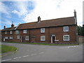
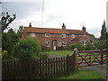
Barnby House
One of the older remaining houses in the village. http://www.britishlistedbuildings.co.uk/en-242646-barnby-house-barnby-in-the-willows-notti
Image: © Jonathan Thacker
Taken: 4 Jun 2011
0.05 miles
3
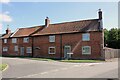
Barnby House, 1 Cross Lane, Barnby in the Willows
Grade II Listed house, former house and cottage built about 1800. The protruding part circular brickwork is the rear of an oven, probably a bread oven. Recent sales particulars describe the property as 'the accommodation includes four/five bedrooms and two/three reception rooms to suit clients needs'.
Image: © Jo and Steve Turner
Taken: 22 Aug 2023
0.05 miles
4
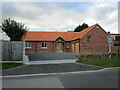
New build bungalow
Barnby has seen little new building in the last couple of decades but this speculative build was completed a few months ago.
Image: © Jonathan Thacker
Taken: 14 Oct 2022
0.05 miles
5
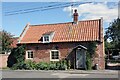
School House, Back Lane, Barnby in the Willows
Grade II Listed mid 18th century cottage. The four bedroom property was sympathetically extended to the rear in 2003. The adjacent school building is dated to 1850 and the 1887 OS maps suggest a link with the school and this cottage, although the design and construction is not consistent. The early OS maps also indicate the rear garden was previously truncated just behind the school and the remaining section was part of the school plot of land. The school closed in 1963 but I can't determine how long the cottage was used as accommodation for the school master/mistress.
Image: © Jo and Steve Turner
Taken: 22 Aug 2023
0.06 miles
6
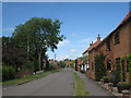
Front Street, Barnby in the Willows
The house on the extreme right was for many years the village Post Office closing in the early 1960s.
Image: © Jonathan Thacker
Taken: 4 Jun 2011
0.06 miles
7
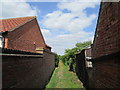
Footpath to Beckingham
Between the houses on Back Lane.
Image: © Jonathan Thacker
Taken: 15 May 2020
0.06 miles
8
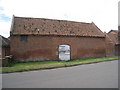
Barn at the Gables
A typical East Nottinghamshire barn still used for its original purpose.
Image: © Jonathan Thacker
Taken: 4 Jun 2011
0.06 miles
9
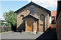
Former Jubilee School, Back Lane, Barnby in the Willows
Former School now a Grade II Listed village hall built in 1850 (date stone). The classical style round-headed recesses appear in the design of a number of school buildings from the 1840s and 1850s. The school closed in 1963 and Jonathan Thacker tells us here https://www.geograph.org.uk/photo/1999405 it had 20 pupils at the time.
Image: © Jo and Steve Turner
Taken: 22 Aug 2023
0.07 miles