
IMAGES TAKEN NEAR TO
Stanley Terrace, NEWARK, NG24 2JA
Introduction
This page details the photographs taken nearby to Stanley Terrace, NG24 2JA by members of the Geograph project.
The Geograph project started in 2005 with the aim of publishing, organising and preserving representative images for every square kilometre of Great Britain, Ireland and the Isle of Man.

There are currently over 7.5m images from over14,400 individuals and you can help contribute to the project by visiting https://www.geograph.org.uk
Image Map
Images are licensed for reuse under creativecommons.org/licenses/by-sa/2.0
Notes
- Clicking on the map will re-center to the selected point.
- The higher the marker number, the further away the image location is from the centre of the postcode.
Image Listing (66 Images Found)
Images are licensed for reuse under creativecommons.org/licenses/by-sa/2.0
Image
Details
Distance
1
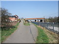
Beacon Hill Road crossing Cycle Route 64
The Route now runs alongside the East Coast Main Line.
Image: © Tim Heaton
Taken: 24 Mar 2011
0.05 miles
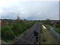
3
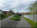
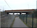
Approaching Beacon Hill Bridge
National Cycle Route No 64. This area was once occupied by a loop line off the East Coast Main Line and the Bottesford to Newark Line. A branch went off to the left to serve Newark's gasworks.
Image: © Jonathan Thacker
Taken: 5 Apr 2024
0.08 miles
4
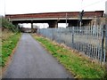
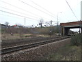
Beacon Hill Bridge
Carrying the Sleaford Road over the national cycle route 64 and the East Coast main railway line.
Image: © Christine Johnstone
Taken: 18 Jan 2014
0.09 miles
7
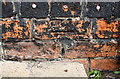
Benchmark on #78 Beacon Hill Road
Ordnance Survey cut mark benchmark described on the Bench Mark Database at http://www.bench-marks.org.uk/bm75285
Image: © Roger Templeman
Taken: 1 May 2016
0.10 miles
8
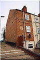
Steps up to Beacon Hill Road passing #78
There is an OS benchmark Image on the side of the house near the top of the steps
Image: © Roger Templeman
Taken: 1 May 2016
0.10 miles
9
Focus, Newark
Taken just before the chain went bust.
Image: © N Chadwick
Taken: 21 Feb 2011
0.12 miles
10

Benchmark on #56 Wood Street
Ordnance Survey cut mark benchmark described on the Bench Mark Database at http://www.bench-marks.org.uk/bm75289
Image: © Roger Templeman
Taken: 1 May 2016
0.13 miles