IMAGES TAKEN NEAR TO
Marles Close, NEWARK, NG24 2FD
Introduction
This page details the photographs taken nearby to Marles Close, NG24 2FD by members of the Geograph project.
The Geograph project started in 2005 with the aim of publishing, organising and preserving representative images for every square kilometre of Great Britain, Ireland and the Isle of Man.

There are currently over 7.5m images from over14,400 individuals and you can help contribute to the project by visiting https://www.geograph.org.uk
Image Map
Images are licensed for reuse under creativecommons.org/licenses/by-sa/2.0
Notes
- Clicking on the map will re-center to the selected point.
- The higher the marker number, the further away the image location is from the centre of the postcode.
Image Listing (13 Images Found)
Images are licensed for reuse under creativecommons.org/licenses/by-sa/2.0
Image
Details
Distance
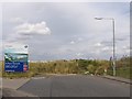
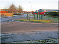
2
Jessop Way
A dead-end on the eastern edge of the Newark Business Park
Image: © David Lally
Taken: 30 Jan 2013
0.08 miles
4
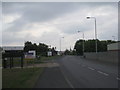
Brunel Drive
The spire of Newark parish church can be seen in the distance.
Image: © Jonathan Thacker
Taken: 4 Jun 2011
0.16 miles
5
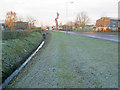
Gully at the Brunel Drive Trading Estate
On a very frosty morning, looking south-west along the drain that parallels Brunel Drive. The flags advertise Cooks & Company, makers of fine kitchens. Newark church spire in the far distance.
Image: © Trevor Rickard
Taken: 10 Dec 2011
0.17 miles
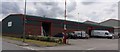
6
An entrance to Beacon Hill Conservation Park
Image: © Jonathan Thacker
Taken: 7 Sep 2019
0.19 miles
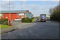
7
Newark Industrial Estate
Looking north-east along Brunel Drive with Brunel Court leading off to the right.
Image: © Trevor Rickard
Taken: 10 Dec 2011
0.19 miles
8
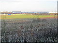
Scrubland north of Beacon Hill
Looking north across the site of the former gypsum mine, which is now a nature reserve managed by the Nottinghamshire Wildlife Trust - see http://www.nottinghamshirewildlife.org/nature-reserves/beacon-hill-conservation-park/
In the background is the large Currys distribution depot on the A1.
Image: © Trevor Rickard
Taken: 10 Dec 2011
0.20 miles
9
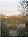
Path off Beacon Hill
Heading north-west on a frosty morning. This whole area was formerly a gypsum mine and landfill site. It is now a nature reserve managed by the Nottinghamshire Wildlife Trust - see http://www.nottinghamshirewildlife.org/nature-reserves/beacon-hill-conservation-park/
The sugar factory is in full production in the distance - see Image
Image: © Trevor Rickard
Taken: 10 Dec 2011
0.21 miles
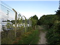
10
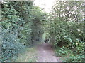
Footpath in Beacon Hill Conservation Park
Image: © Jonathan Thacker
Taken: 7 Sep 2019
0.21 miles