1
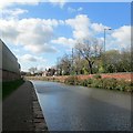
London Road: looking south
The view towards Trent Bridge. The Nottingham Canal is on the other side of the wall on the left, the houses of The Meadows beyond the trees on the right.
Image: © John Sutton
Taken: 9 May 2012
0.03 miles
2
London Road and the Nottingham Canal
Rush-hour traffic and a cruiser moored overnight.
Image: © John Sutton
Taken: 21 Aug 2014
0.04 miles
3
Diverted bus on London Road
With the closure of the bottom of Arkwright Street at Meadows Way, bus services into West Bridgford are being diverted via London Road, which normally has no regular service.
Image: © Alan Murray-Rust
Taken: 13 Sep 2013
0.04 miles
4
Daffodils on London Road
The sun never quite broke through on a cloudy April day.
Image: © John Sutton
Taken: 10 Apr 2013
0.04 miles
5
A stiff breeze on the Nottingham Canal
A view from the towpath on bright but chilly April morning. London Road is to the right.
Image: © John Sutton
Taken: 8 Apr 2014
0.05 miles
6
Building houses on Arkwright Walk
Arkwright Street became Arkwright Walk following a massive slum clearance project in the 1970s. Now some of the houses built then are being replaced.
Image: © John Sutton
Taken: 19 Sep 2019
0.05 miles
7
Mower Word
Industrial building reflected in the Nottingham Canal.
Image: © David Lally
Taken: 15 Jul 2021
0.05 miles
8
Beeston Canal, Nottingham
Whether this should technically be called the Beeston Canal or the Nottingham Canal seems to be a moot point. The original Nottingham Canal ran from the River Trent, just east of this point, to Langley Mill. However, beyond its junction with the Beeston Canal at Lenton, the Nottingham Canal has long been abandoned, effectively making this canal the eastwards extension of the Beeston Canal, which allows boats to avoid Beeston Weir and pass through Nottingham city centre. The stone arch bridge is untypical of the canal bridges in the centre of Nottingham.
Image: © Stephen McKay
Taken: 25 Sep 2007
0.05 miles
9
London Road: demolition site
The curry house next to The Globe has been demolished.
Image] shows the same corner a month before.
Image: © John Sutton
Taken: 12 Jun 2013
0.05 miles
10
London Road: due to be demolished
The boarded-up curry house next to The Globe was ready to be demolished. A month later it had gone:
Image
Image: © John Sutton
Taken: 18 May 2013
0.05 miles


