
IMAGES TAKEN NEAR TO
Meadow Lane, NOTTINGHAM, NG2 3HR
Introduction
This page details the photographs taken nearby to Meadow Lane, NG2 3HR by members of the Geograph project.
The Geograph project started in 2005 with the aim of publishing, organising and preserving representative images for every square kilometre of Great Britain, Ireland and the Isle of Man.

There are currently over 7.5m images from over14,400 individuals and you can help contribute to the project by visiting https://www.geograph.org.uk
Image Map
Images are licensed for reuse under creativecommons.org/licenses/by-sa/2.0
Notes
- Clicking on the map will re-center to the selected point.
- The higher the marker number, the further away the image location is from the centre of the postcode.
Image Listing (645 Images Found)
Images are licensed for reuse under creativecommons.org/licenses/by-sa/2.0
Image
Details
Distance
1
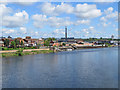
North from Trent Bridge on a May afternoon
Another warehouse on the Meadow Lane side of the river has been demolished since Image] was taken a little over a year before.
Image: © John Sutton
Taken: 14 May 2017
0.01 miles
2
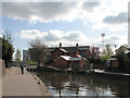
Meadow Lane Lock and the City Ground
A regeneration scheme jointly funded by British Waterways and Nottingham Regeneration Ltd has recently renovated the lock and the Trent riverside. Beneath the new railings on the opposite bank of the canal is an overflow channel which discharges into the Trent. This is one of two places (the other is Wilford) where the canalised and culverted waters of the River Leen reach the Trent. The Leen water entering the Trent here has come slowly along the canal from Lenton, then via the Tinker's Leen flood channel, behind the old Hicking Pentecost works, under London Road and into the canal again. Prominent on the far bank of the river, in the background, is the Trent End of Nottingham Forest's City Ground - but it was ten in the morning and I was on my way to Trent Bridge for the first day of Notts-Somerset (which Notts won on the third day of four).
Image: © John Sutton
Taken: 21 Apr 2010
0.01 miles
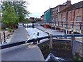
4
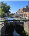
Meadow Lane Lock
The lock brings canal traffic down to river level.
Image: © John Sutton
Taken: 19 Sep 2019
0.01 miles
5
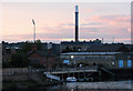
Pink sky over Meadow Lane Lock
A view across the river from the Bridgford side of Trent Bridge. Under the Trent Carriers lettering on the corrugated sheds to the right are vestiges of the name of the original owner, Trent Navigation. Eastcroft Incinerator is in the background; the other vertical is one of the floodlights at Notts County's Meadow Lane football ground.
Image: © John Sutton
Taken: 7 Sep 2010
0.01 miles
6
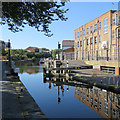
Reflections at Meadow Lane Lock
The lock is where the Nottingham Canal meets the River Trent.
Image: © John Sutton
Taken: 19 Sep 2019
0.01 miles
7
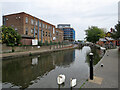
Near Meadow Lane Lock
The view is changing with the building of the Trent Bridge Quays flats, currently surrounded by scaffolding. Image] shows this part of the world in September 2009.
Image: © John Sutton
Taken: 23 May 2021
0.01 miles
8

Tinker's Leen outlet, Meadow Lane Lock
Tinker's Leen starts partly as an overflow from the Nottingham Canal above Wilford Road Lock https://www.geograph.org.uk/photo/3049538 . It is then largely culverted with some open sections before discharging here. The gate is a necessary flood defence.
Image: © Alan Murray-Rust
Taken: 10 Oct 2021
0.01 miles
9
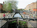
Meadow Lane lock from the River Trent to the Nottingham Canal
Image: © Roy Hughes
Taken: 16 Apr 2022
0.01 miles
10
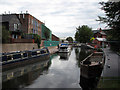
Meadow Lane Lock
This is where the Nottingham Canal joins the Trent. Men are at work on a regeneration scheme funded by British Waterways, the East Midlands Development Agency and others.
Image: © John Sutton
Taken: 23 Sep 2009
0.01 miles