IMAGES TAKEN NEAR TO
Fosse Road, NEWARK, NG23 7QB
Introduction
This page details the photographs taken nearby to Fosse Road, NG23 7QB by members of the Geograph project.
The Geograph project started in 2005 with the aim of publishing, organising and preserving representative images for every square kilometre of Great Britain, Ireland and the Isle of Man.

There are currently over 7.5m images from over14,400 individuals and you can help contribute to the project by visiting https://www.geograph.org.uk
Image Map
Images are licensed for reuse under creativecommons.org/licenses/by-sa/2.0
Notes
- Clicking on the map will re-center to the selected point.
- The higher the marker number, the further away the image location is from the centre of the postcode.
Image Listing (11 Images Found)
Images are licensed for reuse under creativecommons.org/licenses/by-sa/2.0
Image
Details
Distance
1
Confusing road junction
The Old A46 joins the new A46, but traffic is not allowed this way.
Image: © J.Hannan-Briggs
Taken: 31 Mar 2012
0.01 miles
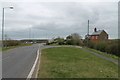
2
Fosseway
Field House Farm Cottage on the old A46 on the line of the Roman Fosseway
Image: © Richard Croft
Taken: 25 Apr 2007
0.02 miles
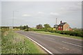
3
Field House Farm
Field House Farm and Field House Farm Cottage at Brough
Image: © Richard Croft
Taken: 25 Apr 2007
0.04 miles
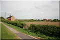
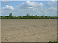
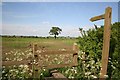
4

Field adjacent to Field House, Brough
Image: © Jonathan Thacker
Taken: 22 Jan 2022
0.11 miles
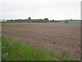
6
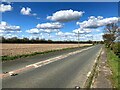
Unnamed Road near Brough
This road joins the A46 a little further ahead and is pictured from the southern edge of this square.
Image: © Jonathan Clitheroe
Taken: 30 Mar 2024
0.14 miles
7
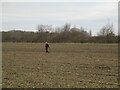
Metal detector near Brough
Brough was a Roman settlement and this field is adjacent to the Fosse Way.
Image: © Jonathan Thacker
Taken: 22 Jan 2022
0.14 miles
8
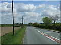
The old A46
Now bypassed by a new dual carriageway.
Image: © JThomas
Taken: 12 May 2012
0.16 miles
10
Footpath to Brills Hill
From Stapleford Lane towards Brills Hill with Field House just visible
Image: © Richard Croft
Taken: 25 May 2006
0.21 miles