IMAGES TAKEN NEAR TO
Pinfold Lane, NEWARK, NG23 5RD
Introduction
This page details the photographs taken nearby to Pinfold Lane, NG23 5RD by members of the Geograph project.
The Geograph project started in 2005 with the aim of publishing, organising and preserving representative images for every square kilometre of Great Britain, Ireland and the Isle of Man.

There are currently over 7.5m images from over14,400 individuals and you can help contribute to the project by visiting https://www.geograph.org.uk
Image Map
Images are licensed for reuse under creativecommons.org/licenses/by-sa/2.0
Notes
- Clicking on the map will re-center to the selected point.
- The higher the marker number, the further away the image location is from the centre of the postcode.
Image Listing (18 Images Found)
Images are licensed for reuse under creativecommons.org/licenses/by-sa/2.0
Image
Details
Distance
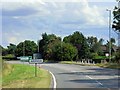
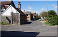
1
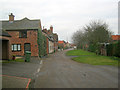
Pinfold Lane
Quiet residential lane leading west off Staythorpe Road.
Image: © Trevor Rickard
Taken: 30 Jan 2012
0.00 miles
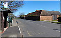
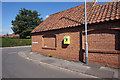
4
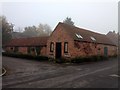
Manor Cottage Barn
Barn conversion in Averham village
Image: © Graham Hogg
Taken: 2 Nov 2015
0.06 miles
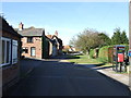
6
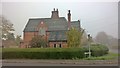
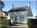
House at corner of Staythorpe Road and Pinfold Lane, Averham
Image: © Chris Morgan
Taken: 2 Nov 2015
0.08 miles