IMAGES TAKEN NEAR TO
Fosse Road, NEWARK, NG23 5QH
Introduction
This page details the photographs taken nearby to Fosse Road, NG23 5QH by members of the Geograph project.
The Geograph project started in 2005 with the aim of publishing, organising and preserving representative images for every square kilometre of Great Britain, Ireland and the Isle of Man.

There are currently over 7.5m images from over14,400 individuals and you can help contribute to the project by visiting https://www.geograph.org.uk
Image Map
Images are licensed for reuse under creativecommons.org/licenses/by-sa/2.0
Notes
- Clicking on the map will re-center to the selected point.
- The higher the marker number, the further away the image location is from the centre of the postcode.
Image Listing (5 Images Found)
Images are licensed for reuse under creativecommons.org/licenses/by-sa/2.0
Image
Details
Distance
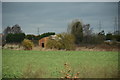
3
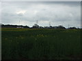
Oilseed rape crop
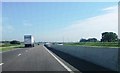
Looking towards the recently opened new A46.
Image: © JThomas
Taken: 7 Apr 2012
0.12 miles
4
A derelict building near Farndon, Newark
Located in a field, by the A46.
Image: © Oliver Mills
Taken: 27 Mar 2016
0.19 miles