
IMAGES TAKEN NEAR TO
Main Street, NEWARK, NG23 5PX
Introduction
This page details the photographs taken nearby to Main Street, NG23 5PX by members of the Geograph project.
The Geograph project started in 2005 with the aim of publishing, organising and preserving representative images for every square kilometre of Great Britain, Ireland and the Isle of Man.

There are currently over 7.5m images from over14,400 individuals and you can help contribute to the project by visiting https://www.geograph.org.uk
Image Map
Images are licensed for reuse under creativecommons.org/licenses/by-sa/2.0
Notes
- Clicking on the map will re-center to the selected point.
- The higher the marker number, the further away the image location is from the centre of the postcode.
Image Listing (29 Images Found)
Images are licensed for reuse under creativecommons.org/licenses/by-sa/2.0
Image
Details
Distance
1

Thorpe hamlet
Very much a manor based hamlet with church, rectory a couple of farms (one being the manor) and various farm workers' cottages. The white cottage remarkably takes its name from the little red object on the opposite of the road - it's called Post Box Cottage.
Image: © Alan Murray-Rust
Taken: 10 Dec 2009
0.02 miles
2

Manor Farm, Thorpe
The farm complex has been converted to residential use.
Image: © Alan Murray-Rust
Taken: 10 Dec 2009
0.03 miles
3

Manor Farm, Thorpe
The high window in the middle of the facade is unusual.
Image: © Alan Murray-Rust
Taken: 10 Dec 2009
0.04 miles
4
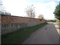
Wall in Thorpe
This wall is constructed from local blue lias stone and later brickwork and is not untypical of many older constructions in the Newark area.
Image: © Jonathan Thacker
Taken: 25 Feb 2012
0.06 miles
5
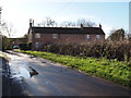
Thorpe, Notts.
A row of cottages situated at the mid-point of Main Street as it passes through the village. This is a hamlet lying to the east of East Stoke - approximately a mile off the Fosse Way, a.k.a. the Foss Way (the former A46 road) - in a rural location southwest of Newark.
Image: © David Hallam-Jones
Taken: 10 Jan 2016
0.06 miles
6

Temporary Closure notice
Showing the extent of closure of Farndon Footpath 11 during the construction of the A46. This is the notice visible on the signpost in http://www.geograph.org.uk/photo/1620173
Image: © Alan Murray-Rust
Taken: 10 Dec 2009
0.07 miles
7

Lane to the A46
At least it used to be, but with the improvements to the latter it is now permanently closed.
Image: © Alan Murray-Rust
Taken: 10 Dec 2009
0.08 miles
8
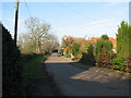
Thorpe Village
The village of Thorpe which lies 5 miles South of Newark
Image: © Bob Danylec
Taken: 19 Nov 2005
0.08 miles
9
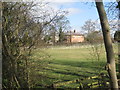
View towards Thorpe church and rectory
The intervening field divided into paddocks.
Image: © Jonathan Thacker
Taken: 25 Feb 2012
0.09 miles
10

Thorpe Church and Old Rectory
The latter dates from around 1830 and is Listed grade II. The marked footpath used to provide a direct link to Farndon but is currently closed due to the works on the A46. It seems improbable that the link will be reopened when the road is finished.
Image: © Alan Murray-Rust
Taken: 10 Dec 2009
0.09 miles