
IMAGES TAKEN NEAR TO
Moor Lane, NEWARK, NG23 5NA
Introduction
This page details the photographs taken nearby to Moor Lane, NG23 5NA by members of the Geograph project.
The Geograph project started in 2005 with the aim of publishing, organising and preserving representative images for every square kilometre of Great Britain, Ireland and the Isle of Man.

There are currently over 7.5m images from over14,400 individuals and you can help contribute to the project by visiting https://www.geograph.org.uk
Image Map
Images are licensed for reuse under creativecommons.org/licenses/by-sa/2.0
Notes
- Clicking on the map will re-center to the selected point.
- The higher the marker number, the further away the image location is from the centre of the postcode.
Image Listing (47 Images Found)
Images are licensed for reuse under creativecommons.org/licenses/by-sa/2.0
Image
Details
Distance
1
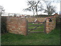
The village pound
Restored for the Queen's Golden Jubilee in 2002.
Image: © Jonathan Thacker
Taken: 9 Mar 2012
0.02 miles
2
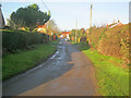
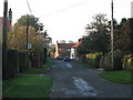
Moor Lane at Syerston
Looking west along the narrow village road, which is a dead-end at this end.
Image: © Trevor Rickard
Taken: 28 Jan 2012
0.03 miles
3
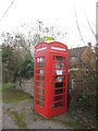
Syerston book exchange
Do telephone kiosks dream of one day becoming telephone exchanges? If so this one can claim to having become an exchange (of sorts).
Image: © Jonathan Thacker
Taken: 9 Mar 2012
0.04 miles
4
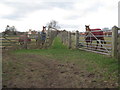
Guardians of the path
You may only pass if you provide sugar lumps.
Image: © Jonathan Thacker
Taken: 9 Mar 2012
0.05 miles
6
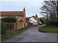
Moor Lane
Looking south east from the junction with Hawksworth Road.
Image: © Alan Murray-Rust
Taken: 8 Dec 2009
0.06 miles
7
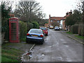
Moor Lane
Looking north west. This is more or less the centre of the village. The telephone box is empty, but despite being of the K6 type, is not Listed.
Image: © Alan Murray-Rust
Taken: 8 Dec 2009
0.06 miles
8
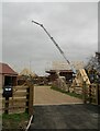
New houses under construction, Syerston
Image: © Jonathan Thacker
Taken: 2 Feb 2022
0.06 miles
9
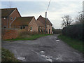
Moor Lane
The buildings are former outbuildings of Low Farm, now converted to residential use. The furthest, tall, barn is Listed Grade II.
Image: © Alan Murray-Rust
Taken: 8 Dec 2009
0.07 miles
10
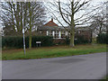
Syerston Village Hall
Only a small hall, but only a small village!
Image: © Alan Murray-Rust
Taken: 8 Dec 2009
0.08 miles