IMAGES TAKEN NEAR TO
Bakers Lane, NEWARK, NG23 5HL
Introduction
This page details the photographs taken nearby to Bakers Lane, NG23 5HL by members of the Geograph project.
The Geograph project started in 2005 with the aim of publishing, organising and preserving representative images for every square kilometre of Great Britain, Ireland and the Isle of Man.

There are currently over 7.5m images from over14,400 individuals and you can help contribute to the project by visiting https://www.geograph.org.uk
Image Map
Images are licensed for reuse under creativecommons.org/licenses/by-sa/2.0
Notes
- Clicking on the map will re-center to the selected point.
- The higher the marker number, the further away the image location is from the centre of the postcode.
Image Listing (54 Images Found)
Images are licensed for reuse under creativecommons.org/licenses/by-sa/2.0
Image
Details
Distance
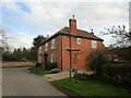
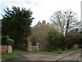
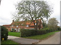
2
House in Westborough
It has an imposing presence at it faces down the village street.
Image: © Jonathan Thacker
Taken: 22 Oct 2010
0.02 miles
3
The Dovecote House, Westborough
Many buildings in Westborough exhibit lias stone walling This stone is poor by comparison with the limestones of only a few miles away. Other examples of its use can be found in several villages around Newark on Trent including Collingham, Langford, Dry Doddington and Long Bennington.
The Dovecote was the part of the building furthest from the photographer and as a boy I remember it as being a great place to play !
Image: © Jonathan Thacker
Taken: 22 Oct 2010
0.03 miles
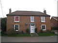
4
The Old Rectory, Westborough
The oldest parts date to the sixteenth century, though the bulk of the building dates from the eighteenth century https://historicengland.org.uk/listing/the-list/list-entry/1253451
Image: © Jonathan Thacker
Taken: 15 Mar 2021
0.04 miles
5
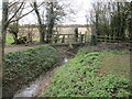
Footbridge over Western Drain, Westborough
Image: © Jonathan Thacker
Taken: 15 Mar 2021
0.05 miles

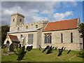
7
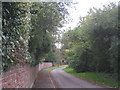
Garden Wall, Westborough
Looking towards the church, the porch of which is visible in the distance.
Image: © Jonathan Thacker
Taken: 22 Oct 2010
0.07 miles
8
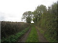
The Viking Way at Westborough
Looking in the direction of Long Bennington.
Image: © Jonathan Thacker
Taken: 22 Oct 2010
0.07 miles
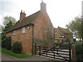
9
Cottages in Westborough
Many buildings in Westborough exhibit lias stone walling. This stone is poor by comparison with the limestones of only a few miles away. Other examples of its use can be found in several villages around Newark on Trent including Collingham, Langford, Dry Doddington and Long Bennington.
Image: © Jonathan Thacker
Taken: 22 Oct 2010
0.08 miles