
IMAGES TAKEN NEAR TO
Healey Close, NOTTINGHAM, NG2 2HL
Introduction
This page details the photographs taken nearby to Healey Close, NG2 2HL by members of the Geograph project.
The Geograph project started in 2005 with the aim of publishing, organising and preserving representative images for every square kilometre of Great Britain, Ireland and the Isle of Man.

There are currently over 7.5m images from over14,400 individuals and you can help contribute to the project by visiting https://www.geograph.org.uk
Image Map
Images are licensed for reuse under creativecommons.org/licenses/by-sa/2.0
Notes
- Clicking on the map will re-center to the selected point.
- The higher the marker number, the further away the image location is from the centre of the postcode.
Image Listing (878 Images Found)
Images are licensed for reuse under creativecommons.org/licenses/by-sa/2.0
Image
Details
Distance
1
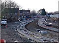
Tram tracks on Meadows Way
Both tracks are laid and the road surface is in the course of being added.
Image: © Alan Murray-Rust
Taken: 2 Feb 2014
0.02 miles
2
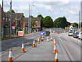
Meadows Way East
It shouldn't be long before this section of road is reopened to traffic.
Image: © Alan Murray-Rust
Taken: 14 May 2014
0.03 miles
3
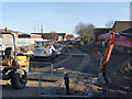
Meadows Way looking east from Sherriff's Way
Trackbed is now in place for the westbound track; the eastbound has been in place for some months.
Image: © Alan Murray-Rust
Taken: 1 Dec 2013
0.03 miles
4
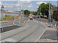
Meadows Way junction
At this point the tram has its own section of carriageway just in advance of the junction of the two routes.
Image: © Alan Murray-Rust
Taken: 21 Jul 2014
0.03 miles
5
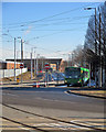
The tramway nearing completion at Sheriffs Way
The double track ahead leads to the railway station, the city centre and the northern part of the NET system. In the foreground the Clifton route swings into Queen's Walk. The Chilwell line follows Meadows Way (offstage left).
Image: © John Sutton
Taken: 9 Feb 2015
0.03 miles
6
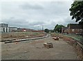
Meadows Way: preparing to lay tram track
By way of comparison, see Image (April 2013). Part of the Victorian factory building on Crocus Street (to the left of centre in the middle distance) has been demolished since that picture was taken. The tram line will curve sharply to the left to cross Arkwright Street, then rise to cross the railway station on the Karlsruhe Friendship Bridge.
Image: © John Sutton
Taken: 22 Jun 2013
0.03 miles
7
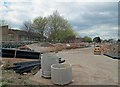
Lowering Meadows Way for the tram
The road is being lowered to the level of the land to the left. The tram routes will divide at the top of Queen's Walk.
Image: © John Sutton
Taken: 30 Apr 2013
0.03 miles
8
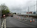
Tram tracks in Meadows Way
The tracks and the overhead poles are in place, the road surface has been restored and the road is in use. Image] shows the state of play two months before.
Image: © John Sutton
Taken: 7 Apr 2014
0.03 miles
9
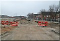
Meadows Way: excavations for the tram line
Meadows Way is being lowered to the same level as the houses of the Meadows Estate. There will be a tight curve to take the line across Arkwright Street.
Image: © John Sutton
Taken: 11 Apr 2013
0.04 miles
10
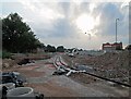
Rails in place at Meadows Way
An evening view against the light shows that rails have been fixed to the concrete trackbase since Alan Murray-Rust passed this way at the end of July - Image
Image: © John Sutton
Taken: 22 Aug 2013
0.04 miles