
IMAGES TAKEN NEAR TO
Riverdale Road, NEWARK, NG22 9WR
Introduction
This page details the photographs taken nearby to Riverdale Road, NG22 9WR by members of the Geograph project.
The Geograph project started in 2005 with the aim of publishing, organising and preserving representative images for every square kilometre of Great Britain, Ireland and the Isle of Man.

There are currently over 7.5m images from over14,400 individuals and you can help contribute to the project by visiting https://www.geograph.org.uk
Image Map
Images are licensed for reuse under creativecommons.org/licenses/by-sa/2.0
Notes
- Clicking on the map will re-center to the selected point.
- The higher the marker number, the further away the image location is from the centre of the postcode.
Image Listing (22 Images Found)
Images are licensed for reuse under creativecommons.org/licenses/by-sa/2.0
Image
Details
Distance
1
Benches on Hallam New Road
Looking at the frame in front of these benches this was some sort of commemorative event now defaced.
Image: © Steve Fareham
Taken: 4 Jul 2008
0.15 miles
2
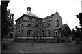
Boughton Pumping Station
This is the smaller 'standby station' that had a Hathorn, Davey horizontal tandem compound 'differential' pump and an inverted vertical triple expansion pump. Beyond can be glimpsed the huge pumping station that housed a pair of triple expansion engines with horizontal high pressure cylinders and inverted vertical intermediate and low pressure cylinders. These were built by Ashton, Frost of Blackburn and scrapped in the 1970s.
Image: © Chris Allen
Taken: 26 May 1985
0.21 miles
3
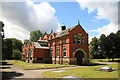
Boughton Pumping Station
This was the "back-up" plant and comprised a Hathorn, Davey tandem compound "differential" engine, an inverted vertical triple expansion pumping engine and boilers. This is on the operational site and can no longer be approached.
Image: © Chris Allen
Taken: 19 Jul 2008
0.22 miles
4
Boughton Pumping Station
Pictured from the Robin Hood Way on the opposite bank of the River Maun.
Image: © Jonathan Clitheroe
Taken: 2 Aug 2022
0.22 miles
5
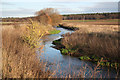
River Maun
The River Maun on Whitewater Common
Image: © Richard Croft
Taken: 27 Dec 2011
0.22 miles
6
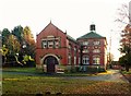
Boughton Pumping Station, minor pump house (Davy House)
Built 1905, originally housing 130 hp (97 kW) Davy horizontal engine and triple-expansion engine by Fairbairn Lawson Combe Barbour. Still in use for pumping, although converted to electric pumps in the late 1960s. Listed Grade II.
Image: © Alan Murray-Rust
Taken: 1 Dec 2019
0.22 miles
7
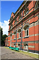
Boughton Pumping Station
This is part of the facade of the main engine house that held a pair of Ashton, Frost triple expansion engines with both horizontal (HP) and inverted vertical cylinders (IP and LP). These were scrapped in the 1970s. The green beam is (I think) part of the support structure for the well pump bell-crank assembly.
A modern fence prevents a view from further away and without a fish-eye this was the best I could do.
Image: © Chris Allen
Taken: 19 Jul 2008
0.22 miles
8
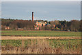
Boughton Pumping Station
Long view from the bridleway beside the River Maun
Image: © Richard Croft
Taken: 27 Dec 2011
0.23 miles
9
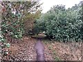
Robin Hood Way near Ollerton
The trail cuts across the north west corner of the grid square here.
Image: © Jonathan Clitheroe
Taken: 2 Aug 2022
0.23 miles
10
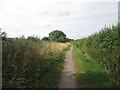
Bridleway along the River Maun
No view of the river along here (it runs a few metres to the left of the track along here).
Image: © John Slater
Taken: 21 Jul 2019
0.24 miles