1
Variations on a theme 2
New Ollerton was built in the 1920/30s in conjuction with the opening of Ollerton Colliery by the Butterley Company. Most of the houses are three bedroom semi- detached built to a small number of designs which are repeated in an apparently random way.
Image: © Jonathan Thacker
Taken: 18 Dec 2015
0.01 miles
2
Variations on a theme 1
New Ollerton was built in the 1920/30s in conjuction with the opening of Ollerton Colliery by the Butterley Company. Most of the houses are three bedroom semi- detached built to a small number of designs which are repeated in an apparently random way.
Image: © Jonathan Thacker
Taken: 18 Dec 2015
0.01 miles
3
Variations on a theme 3
New Ollerton was built in the 1920/30s in conjuction with the opening of Ollerton Colliery by the Butterley Company. Most of the houses are three bedroom semi- detached built to a small number of designs which are repeated in an apparently random way.
Image: © Jonathan Thacker
Taken: 18 Dec 2015
0.03 miles
4
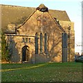
St Paulinus Church New Ollerton
At the junctions of Briar Rd, Larch Rd, Yew Tree Rd, and Lime Tree Rd, St Paulinus is in the middle of a large roundabout, known locally as Church Circle
Image: © Geoff Dunn
Taken: 22 Jan 2006
0.05 miles
5
Variations on a theme 4
New Ollerton was built in the 1920/30s in conjuction with the opening of Ollerton Colliery by the Butterley Company. Most of the houses are three bedroom semi- detached built to a small number of designs which are repeated in an apparently random way.
Image: © Jonathan Thacker
Taken: 18 Dec 2015
0.06 miles
6
Variations on a theme 5
New Ollerton was built in the 1920/30s in conjunction with the opening of Ollerton Colliery by the Butterley Company. Most of the houses are three bedroom semi- detached built to a small number of designs which are repeated in an apparently random way. Many of the houses have subsequently been modified (as here) but the basic pattern can still be seen.
Image: © Jonathan Thacker
Taken: 18 Dec 2015
0.07 miles
7
Ollerton & Bevercotes Miners Welfare
Image: © Mick Garratt
Taken: 7 Oct 2007
0.08 miles
8
Briar Road, New Ollerton
Looking north towards St.Paulinus' Church.
Image: © JThomas
Taken: 19 Mar 2015
0.11 miles
9
Church of St Paulinus, New Ollerton
Foundation stone in the east wall.
Image: © Alan Murray-Rust
Taken: 1 Dec 2019
0.11 miles
10
Church of St Paulinus, New Ollerton
South transept and porch.
Built in 1931 by the Butterley Company as part the first phase of the construction of New Ollerton as a mining town following the sinking of a new shaft in 1922, which led to a large influx of workers, particularly from the North East. The dedication to St Paulinus an early Northumbrian saint, reflects the north-east connection. It is built in an Italianate-romanesque idiom in bricks that were specially commissioned from the Butterley Company. Listed Grade II.
Image: © Alan Murray-Rust
Taken: 1 Dec 2019
0.11 miles


