
IMAGES TAKEN NEAR TO
Yates Croft, NEWARK, NG22 8WL
Introduction
This page details the photographs taken nearby to Yates Croft, NG22 8WL by members of the Geograph project.
The Geograph project started in 2005 with the aim of publishing, organising and preserving representative images for every square kilometre of Great Britain, Ireland and the Isle of Man.

There are currently over 7.5m images from over14,400 individuals and you can help contribute to the project by visiting https://www.geograph.org.uk
Image Map
Images are licensed for reuse under creativecommons.org/licenses/by-sa/2.0
Notes
- Clicking on the map will re-center to the selected point.
- The higher the marker number, the further away the image location is from the centre of the postcode.
Image Listing (30 Images Found)
Images are licensed for reuse under creativecommons.org/licenses/by-sa/2.0
Image
Details
Distance
1
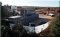
Cockett Lane, Farnsfield, Notts.
Opposite the western-most end of Birch Avenue, where a farm gate previously led into a number of fields (perhaps once owned by Ash Farm?), a new housing development of 88 x two, three, four and five-bedroom homes is now under way. It will be called St Michael’s View.
Image: © David Hallam-Jones
Taken: 30 Jan 2015
0.04 miles
2
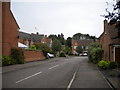
Murdoch Close, Farnsfield
A residential cul de sac off Cockett Lane near the west end of the village.
Image: © Richard Vince
Taken: 2 Aug 2014
0.06 miles
3
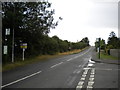
Cockett Lane, Farnsfield
Looking towards the northern extremity of the village from the end of Birch Avenue.
Image: © Richard Vince
Taken: 2 Aug 2014
0.08 miles
4
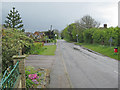
Cockett Lane
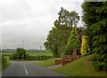
Looking south on a damp afternoon. Neat Farnsfield bungalows on the left around the entrance to Birch Avenue.
Image: © Trevor Rickard
Taken: 8 May 2010
0.08 miles
6
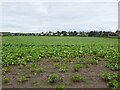
Sugar beet field and the western fringe of Farnsfield
The houses are in the next square north.
Image: © Jonathan Thacker
Taken: 23 Sep 2023
0.12 miles
8
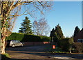
Off Station Lane, Farnsfield, Notts.
This track off Station Lane provides access to a single residential property and an access point onto the Southwell Trail. The 7.5 mile former railway trail runs from Southwell to Bilsthorpe, via Kirklington and Farnsfield.
Image: © David Hallam-Jones
Taken: 13 Dec 2014
0.14 miles
9
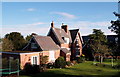
Station Lane, Farnsfield, Notts.
Former station premises off Station Road, seen from near the railway bridge on Cockett Lane that once carried this lane over the Mansfield-Southwell Railway, a line that opened in 1875 and closed to passenger traffic in 1929. The house is a private residence. Station Road, that links Cockett Lane to New Lane (in the centre of the village) was formerly called Sidings Lane.
Image: © David Hallam-Jones
Taken: 30 Jan 2015
0.14 miles
10

Cockett Lane, Farnsfield, Notts.
A car using the bridge that previously carried Cockett Lane over the Mansfield-Southwell Railway, a line that opened c.1875 and closed to passenger traffic in 1929. Individuals looking over the bridge can see the former station/station house - now a private residence - at the side of the Southwell Trail (a medium-distance trail). Station Road, a few paces to the left, in the front of this car, links Cockett Lane to New Lane (in the centre of the village). In several fields on the left-hand side of this picture, although not visible, a new 88 home housing development called St Michael's View has begun.
Image: © David Hallam-Jones
Taken: 30 Jan 2015
0.16 miles