IMAGES TAKEN NEAR TO
Mickledale Lane, NEWARK, NG22 8RD
Introduction
This page details the photographs taken nearby to Mickledale Lane, NG22 8RD by members of the Geograph project.
The Geograph project started in 2005 with the aim of publishing, organising and preserving representative images for every square kilometre of Great Britain, Ireland and the Isle of Man.

There are currently over 7.5m images from over14,400 individuals and you can help contribute to the project by visiting https://www.geograph.org.uk
Image Map
Images are licensed for reuse under creativecommons.org/licenses/by-sa/2.0
Notes
- Clicking on the map will re-center to the selected point.
- The higher the marker number, the further away the image location is from the centre of the postcode.
Image Listing (12 Images Found)
Images are licensed for reuse under creativecommons.org/licenses/by-sa/2.0
Image
Details
Distance
1
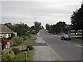
View east along Mickledale Lane, Bilsthorpe
Image: © Tom Courtney
Taken: 2 Oct 2005
0.03 miles
2
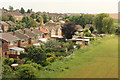
Bilsthorpe
Houses in Micklevale Close on the edge of Bilsthorpe
Image: © Richard Croft
Taken: 20 Jun 2014
0.10 miles
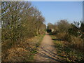
3

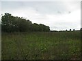
Fairfield Farm
Foxgloves and the view from the new cycle track to Fairfield Farm
Image: © Richard Croft
Taken: 20 Jun 2014
0.14 miles
4
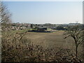
Houses and farm buildings on the edge of Bilsthorpe
Image: © Jonathan Thacker
Taken: 23 Mar 2022
0.14 miles
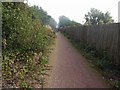
6
Course of railway line to the former Bilsthorpe Colliery
Now part of National Cycle Route 645.
Image: © Jonathan Thacker
Taken: 23 Mar 2022
0.16 miles
7
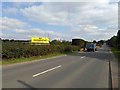
No incinerator campaign banner Bilsthorpe
Image: © Steve Fareham
Taken: 29 Sep 2015
0.17 miles
8
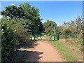
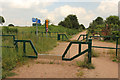
Cycle Path and Footpath Junction near Bilsthorpe
A public footpath intersects the cycle route here, hence the barriers.
Image: © Jonathan Clitheroe
Taken: 27 Aug 2022
0.17 miles
9
Bilsthorpe cycle track
A range of anti-motorbike obstacles and signs on the new cycle track at Bilsthorpe
Image: © Richard Croft
Taken: 20 Jun 2014
0.18 miles