IMAGES TAKEN NEAR TO
Oldbridge Way, NEWARK, NG22 8PU
Introduction
This page details the photographs taken nearby to Oldbridge Way, NG22 8PU by members of the Geograph project.
The Geograph project started in 2005 with the aim of publishing, organising and preserving representative images for every square kilometre of Great Britain, Ireland and the Isle of Man.

There are currently over 7.5m images from over14,400 individuals and you can help contribute to the project by visiting https://www.geograph.org.uk
Image Map
Images are licensed for reuse under creativecommons.org/licenses/by-sa/2.0
Notes
- Clicking on the map will re-center to the selected point.
- The higher the marker number, the further away the image location is from the centre of the postcode.
Image Listing (16 Images Found)
Images are licensed for reuse under creativecommons.org/licenses/by-sa/2.0
Image
Details
Distance
3
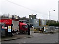
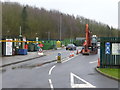
Hazardous waste disposal facility
Just a short distance away from a council waste disposal/recycling site Image
Image: © Graham Hogg
Taken: 5 Jan 2016
0.12 miles
4
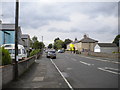
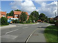
East end of Church Street, Bilsthorpe
Seen from near Eakring Road. Some of the residents have evidently taken it upon themselves to break up the predominantly grey expanse of housing at this end of the village.
Image: © Richard Vince
Taken: 2 Aug 2014
0.15 miles
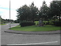
5
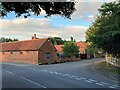
Road Junction and Rectory Barn in Bilsthorpe
Church Hill leading to The Church of St Margaret is to the right of picture.
Image: © Jonathan Clitheroe
Taken: 26 Aug 2022
0.19 miles
6
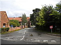
Bottom of Church Hill, Bilsthorpe
Seen from Kirklington Road.
Image: © Richard Vince
Taken: 2 Aug 2014
0.20 miles
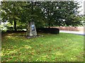
7
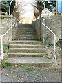
St. Margaret Church Steps
The steps, trodden by thousands of people over the centuries, are at the top of the quite steep Church Hill. Possibly the highest point in Bilsthorpe?
Image: © Dr Margaret Simms
Taken: 6 Nov 2007
0.22 miles
9
Bilsthorpe Recycling Centre
Just a short distance away from a commercial hazardous waste disposal facility Image
Image: © Graham Hogg
Taken: 5 Jan 2016
0.23 miles
10
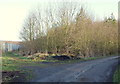
Kirklington Road Vicinity, Bilsthorpe, Notts.
The main track leads from Kirklington Road (behind the photographer) towards a covered reservoir ahead that is sandwiched between Eakring Brail Wood and Long Springs Wood. The footpath running in a north-easterly direction, parallel with the metal fencing, leads to Brail Wood Road (within 5 mins). The fence provides security for a vehicle-dismantling and scrap yard.
Image: © David Hallam-Jones
Taken: 16 Jan 2015
0.23 miles