
IMAGES TAKEN NEAR TO
Spring Court, NEWARK, NG22 8LE
Introduction
This page details the photographs taken nearby to Spring Court, NG22 8LE by members of the Geograph project.
The Geograph project started in 2005 with the aim of publishing, organising and preserving representative images for every square kilometre of Great Britain, Ireland and the Isle of Man.

There are currently over 7.5m images from over14,400 individuals and you can help contribute to the project by visiting https://www.geograph.org.uk
Image Map
Images are licensed for reuse under creativecommons.org/licenses/by-sa/2.0
Notes
- Clicking on the map will re-center to the selected point.
- The higher the marker number, the further away the image location is from the centre of the postcode.
Image Listing (43 Images Found)
Images are licensed for reuse under creativecommons.org/licenses/by-sa/2.0
Image
Details
Distance
1
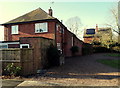
Former G.P. Surgery, Farnsfield, Notts.
The 'sweep in' drive in front of a former G.P's surgery on Station Lane. The new medical centre is situated 2 minutes walk away behind the photographer, near the Cricket Field.
Image: © David Hallam-Jones
Taken: 30 Jan 2015
0.06 miles
2
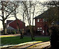
Former Surgery, Station Lane, Farnsfield, Notts.
The large property on the right was a former G.P's surgery. Its 'sweep in' drive is off Station Lane. The new medical centre is situated 2 minutes walk away - to the left - near the Cricket Field, Station Lane.
Image: © David Hallam-Jones
Taken: 30 Jan 2015
0.06 miles
3
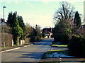
Station Lane, Farnsfield, Notts.
A view of Station Lane from near its junction with Spring Lane. The former Farnsfield railway station building, now a private residence and previously part of the Mansfield-Southwell line (1875-1929) lies a 4-5 minute walk away behind the photographer. The centre of the village is a 2-3 minutes walk ahead. Station Lane was once known as Sidings Lane.
Image: © David Hallam-Jones
Taken: 30 Jan 2015
0.07 miles
4
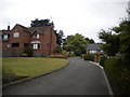
The Spinney, Farnsfield
A private road off Mansfield Road.
Image: © Richard Vince
Taken: 2 Aug 2014
0.08 miles
6
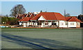
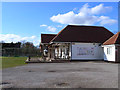
Off Station Lane, Farnsfield, Notts.
This, the second home of Farnsfield Cricket Club, was first used in 1862.
Image: © David Hallam-Jones
Taken: 13 Dec 2014
0.11 miles
7
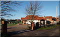
Off Station Lane, Farnsfield, Notts.
The entrance to Farnsfield Cricket Club, Station Lane. This ground, its second home, was first used in 1862.
Image: © David Hallam-Jones
Taken: 13 Dec 2014
0.12 miles
8
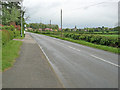
Mansfield Road at Farnsfield
Looking south-east across several meadows towards Farnsfield church.
Image: © Trevor Rickard
Taken: 8 May 2010
0.12 miles
9
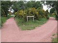
Southwell Trail
A junction 2 miles south of Bilsthorpe. Note the posing rabbit on the path, righthand side middle
Image: © Tom Courtney
Taken: 31 May 2005
0.12 miles
10
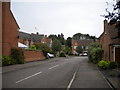
Murdoch Close, Farnsfield
A residential cul de sac off Cockett Lane near the west end of the village.
Image: © Richard Vince
Taken: 2 Aug 2014
0.12 miles