
IMAGES TAKEN NEAR TO
Station Lane, NEWARK, NG22 8LA
Introduction
This page details the photographs taken nearby to Station Lane, NG22 8LA by members of the Geograph project.
The Geograph project started in 2005 with the aim of publishing, organising and preserving representative images for every square kilometre of Great Britain, Ireland and the Isle of Man.

There are currently over 7.5m images from over14,400 individuals and you can help contribute to the project by visiting https://www.geograph.org.uk
Image Map
Images are licensed for reuse under creativecommons.org/licenses/by-sa/2.0
Notes
- Clicking on the map will re-center to the selected point.
- The higher the marker number, the further away the image location is from the centre of the postcode.
Image Listing (119 Images Found)
Images are licensed for reuse under creativecommons.org/licenses/by-sa/2.0
Image
Details
Distance
1
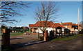
Off Station Lane, Farnsfield, Notts.
The entrance to Farnsfield Cricket Club, Station Lane. This ground, its second home, was first used in 1862.
Image: © David Hallam-Jones
Taken: 13 Dec 2014
0.07 miles
2
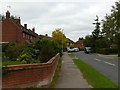
Alexander Road, Farnsfield
1950s housing development on the north side of the village.
Image: © Alan Murray-Rust
Taken: 20 Sep 2020
0.07 miles
3
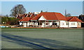
Off Station Lane, Farnsfield, Notts.
This, the second home of Farnsfield Cricket Club, was first used in 1862.
Image: © David Hallam-Jones
Taken: 13 Dec 2014
0.08 miles
5
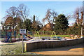
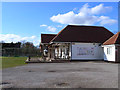
Lady Goodwin's Corner, Farnsfield, Notts.
A view of this children's recreation area from near the Pharmacy, Station Lane. Sir Stuart Coldwell Goodwin, of Hexgreave Hall, Hexgreave Park, Farnsfield was the High Sheriff of Nottinghamshire in 1955.
Image: © David Hallam-Jones
Taken: 6 Dec 2014
0.09 miles
6
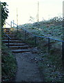
Off Mansfield Road, Farnsfield, Notts.
A flight of steps linking Mansfield Road (behind the photographer) and the local cricket ground (off Station Lane). The local village lock-up is situated half a dozen steps away, on the east side of Mansfield Road.
Image: © David Hallam-Jones
Taken: 13 Dec 2014
0.10 miles
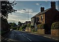
8
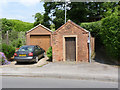
Farnsfield Lockup
This is where petty offenders could be locked up until brought before magistrates. Early 19th century and Listed Grade II.
Image: © Alan Murray-Rust
Taken: 1 Jun 2014
0.10 miles
9
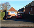
Station Lane, Farnsfield, Notts.
Farnsfield Pharmacy opposite the Farnsfield Tennis Club at the New Hill end of this lane, i.e. near to the centre of the village.
Image: © David Hallam-Jones
Taken: 6 Dec 2014
0.10 miles
10
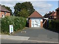
Farnsfield Pharmacy
My immediate impression was that this is a converted small telephone exchange, was confirmed by reference to old OS maps. It was replaced by a larger exchange https://www.geograph.org.uk/photo/4015809 , serving the expanded village, in around 1973.
Image: © Alan Murray-Rust
Taken: 20 Sep 2020
0.10 miles