IMAGES TAKEN NEAR TO
Farnsfield, NEWARK, NG22 8JF
Introduction
This page details the photographs taken nearby to NG22 8JF by members of the Geograph project.
The Geograph project started in 2005 with the aim of publishing, organising and preserving representative images for every square kilometre of Great Britain, Ireland and the Isle of Man.

There are currently over 7.5m images from over14,400 individuals and you can help contribute to the project by visiting https://www.geograph.org.uk
Image Map
Images are licensed for reuse under creativecommons.org/licenses/by-sa/2.0
Notes
- Clicking on the map will re-center to the selected point.
- The higher the marker number, the further away the image location is from the centre of the postcode.
Image Listing (8 Images Found)
Images are licensed for reuse under creativecommons.org/licenses/by-sa/2.0
Image
Details
Distance
2
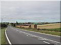
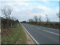
Rufford Forest Farm
just off the A617 and near Rainworth
Image: © Tom Courtney
Taken: 2 Oct 2005
0.09 miles
4
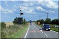
Centenary Avenue
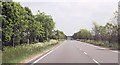
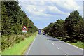
the A617 running east into Rainworth, where the county council have made a nice job of planting trees on either side of the road to mark the year 2000
Image: © Tom Courtney
Taken: 2 Oct 2005
0.12 miles