IMAGES TAKEN NEAR TO
Greaves Lane, NEWARK, NG22 8BN
Introduction
This page details the photographs taken nearby to Greaves Lane, NG22 8BN by members of the Geograph project.
The Geograph project started in 2005 with the aim of publishing, organising and preserving representative images for every square kilometre of Great Britain, Ireland and the Isle of Man.

There are currently over 7.5m images from over14,400 individuals and you can help contribute to the project by visiting https://www.geograph.org.uk
Image Map
Images are licensed for reuse under creativecommons.org/licenses/by-sa/2.0
Notes
- Clicking on the map will re-center to the selected point.
- The higher the marker number, the further away the image location is from the centre of the postcode.
Image Listing (17 Images Found)
Images are licensed for reuse under creativecommons.org/licenses/by-sa/2.0
Image
Details
Distance
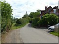
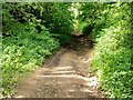
1
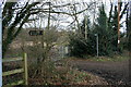
Rob Lane
Junction with Greaves Lane (formerly Graves Lane). Rob Lane was originally the primary route, even as late as 1900.
Image: © Martin Jones
Taken: 3 Jan 2009
0.02 miles
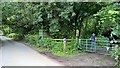
2
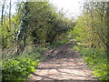
Byway off Greaves Lane west of Wood Farm
Image: © Richard Vince
Taken: 7 May 2016
0.04 miles
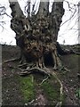
4
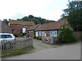
Ewood Farmhouse, Greaves Lane
At the edge of Edingley parish.
Image: © Alan Murray-Rust
Taken: 21 Jul 2020
0.05 miles
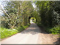
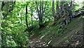
8
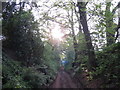
Rob Lane, Edingley
Classed as a byway, very much a classic hollow way at this point.
Image: © Alan Murray-Rust
Taken: 21 Jul 2020
0.11 miles