IMAGES TAKEN NEAR TO
Lincoln Road, NEWARK, NG22 0SL
Introduction
This page details the photographs taken nearby to Lincoln Road, NG22 0SL by members of the Geograph project.
The Geograph project started in 2005 with the aim of publishing, organising and preserving representative images for every square kilometre of Great Britain, Ireland and the Isle of Man.

There are currently over 7.5m images from over14,400 individuals and you can help contribute to the project by visiting https://www.geograph.org.uk
Image Map
Images are licensed for reuse under creativecommons.org/licenses/by-sa/2.0
Notes
- Clicking on the map will re-center to the selected point.
- The higher the marker number, the further away the image location is from the centre of the postcode.
Image Listing (6 Images Found)
Images are licensed for reuse under creativecommons.org/licenses/by-sa/2.0
Image
Details
Distance
2
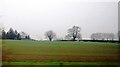
Footpath off Broadgate near east Markham
From the busy A57 trunk road.
Image: © Steve Fareham
Taken: 17 Apr 2009
0.16 miles
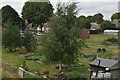
3
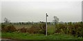
Freightliner passing the allotments
The East Coast Main Line on the edge of East Markham village.
Image: © Alan Murray-Rust
Taken: 22 Aug 2014
0.17 miles
6

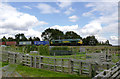
A delight of dahlias
In allotments at the back of Kirke Close.
Image: © Alan Murray-Rust
Taken: 22 Aug 2014
0.21 miles