
IMAGES TAKEN NEAR TO
Queens Drive, NOTTINGHAM, NG2 1AP
Introduction
This page details the photographs taken nearby to Queens Drive, NG2 1AP by members of the Geograph project.
The Geograph project started in 2005 with the aim of publishing, organising and preserving representative images for every square kilometre of Great Britain, Ireland and the Isle of Man.

There are currently over 7.5m images from over14,400 individuals and you can help contribute to the project by visiting https://www.geograph.org.uk
Image Map
Images are licensed for reuse under creativecommons.org/licenses/by-sa/2.0
Notes
- Clicking on the map will re-center to the selected point.
- The higher the marker number, the further away the image location is from the centre of the postcode.
Image Listing (157 Images Found)
Images are licensed for reuse under creativecommons.org/licenses/by-sa/2.0
Image
Details
Distance
1
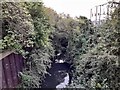
Tottle Brook
Tottle Brook runs in an exposed channel, shortly before it runs into the Trent. For much of the rest its line, in this part of the city, it is culverted.
Image: © Ian Calderwood
Taken: 4 Oct 2023
0.02 miles
2
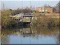
Sluice Gate on the River Trent
I think this marks where the river Leen debouches into the Trent.
Image: © Oxymoron
Taken: 28 Nov 2008
0.03 miles
3
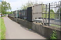
Sluice on east side of Queens Drive
Image: © Roger Templeman
Taken: 13 May 2018
0.03 miles
4
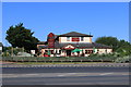
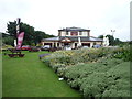
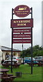
Riverside Farm
Part of the Farmhouse Inns chain.
Image: © Andrew Abbott
Taken: 25 May 2020
0.04 miles
7
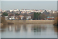
View along the River Trent at Wilford towards Nottingham
The buildings on the skyline Image are part of the development of Nottingham in the early to mid 19th century for the more affluent citizens.
Image: © Alan Murray-Rust
Taken: 9 Jan 2013
0.05 miles
9
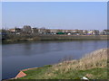
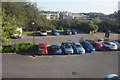
Pie factory
The Pork Farms factory on Queens Drive seen across the River trent from Wilford Church.
Image: © Alan Murray-Rust
Taken: 20 Mar 2009
0.06 miles
10
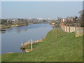
River Trent at Wilford
The wall at the right is of recent construction to increase the height of flood defences. At this point the river is constrained on both sides, forming a bottleneck which will maximise the height at times of maximum flow.
Image: © Alan Murray-Rust
Taken: 20 Mar 2009
0.06 miles