IMAGES TAKEN NEAR TO
The Green, Fourth Avenue, MANSFIELD, NG21 9SD
Introduction
This page details the photographs taken nearby to The Green, Fourth Avenue, NG21 9SD by members of the Geograph project.
The Geograph project started in 2005 with the aim of publishing, organising and preserving representative images for every square kilometre of Great Britain, Ireland and the Isle of Man.

There are currently over 7.5m images from over14,400 individuals and you can help contribute to the project by visiting https://www.geograph.org.uk
Image Map
Images are licensed for reuse under creativecommons.org/licenses/by-sa/2.0
Notes
- Clicking on the map will re-center to the selected point.
- The higher the marker number, the further away the image location is from the centre of the postcode.
Image Listing (15 Images Found)
Images are licensed for reuse under creativecommons.org/licenses/by-sa/2.0
Image
Details
Distance
1
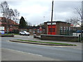
Edwinstowe Fire Station
On Mansfield Road (A6075).
Image: © JThomas
Taken: 17 Mar 2014
0.20 miles
2
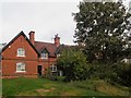
Edwinstowe village
Cottage in West Lane
Image: © norman griffin
Taken: 10 Oct 2017
0.20 miles
3
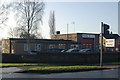
Edwinstowe fire station
Edwinstowe fire station, West Lane, Edwinstowe, Nottinghamshire
Image: © Kevin Hale
Taken: 5 Dec 2009
0.21 miles
4
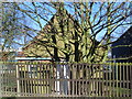
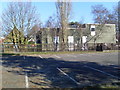
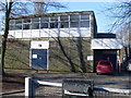
Former Telephone Exchange, Edwinstowe
Situated off the High Street, this former TE behind a tree was replaced in the late 1960s by the present TE which can be seen on the extreme right of the photo.
Image: © David Hillas
Taken: 8 Mar 2010
0.22 miles
5

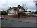
The Manvers Arms
A pub on Mansfield Road, and Welbeck Drive.
Image: © Peter Barr
Taken: 16 Aug 2013
0.23 miles
6
Old and New Telephone Exchanges, Edwinstowe
Situated off the High Street, the old and new TEs can be seen side by side.
Image: © David Hillas
Taken: 8 Mar 2010
0.23 miles
7
The Manvers Arms pub, Edwinstowe
On Mansfield Road (A6075).
Image: © JThomas
Taken: 17 Mar 2014
0.23 miles
8
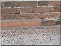
Cut Mark: Edwinstowe Village Hall
Only the datum cut is visible, arrow cuts having been lost to brick replacement. See http://www.geograph.org.uk/photo/3424016 for a wider view and http://www.bench-marks.org.uk/bm48246 for details of the mark.
Image: © Brian Westlake
Taken: 17 Sep 2012
0.24 miles
9
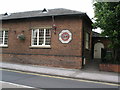
Edwinstowe Village Hall
The east end of the village hall, and former schoolhouse. It carries a cut bench mark low down near the right-hand angle. See http://www.geograph.org.uk/photo/3424006 for a close-up.
Image: © Brian Westlake
Taken: 17 Sep 2012
0.24 miles
10
Telephone Exchange, Edwinstowe
Situated in High Street, this TE, of standard design, also serves Budby, Old Clipstone and Ollerton nearby, in addition to Edwinstowe. Its postcode is NG21 9QS.
Image: © David Hillas
Taken: 8 Mar 2010
0.24 miles