IMAGES TAKEN NEAR TO
King Edwins Close, MANSFIELD, NG21 9RH
Introduction
This page details the photographs taken nearby to King Edwins Close, NG21 9RH by members of the Geograph project.
The Geograph project started in 2005 with the aim of publishing, organising and preserving representative images for every square kilometre of Great Britain, Ireland and the Isle of Man.

There are currently over 7.5m images from over14,400 individuals and you can help contribute to the project by visiting https://www.geograph.org.uk
Image Map
Images are licensed for reuse under creativecommons.org/licenses/by-sa/2.0
Notes
- Clicking on the map will re-center to the selected point.
- The higher the marker number, the further away the image location is from the centre of the postcode.
Image Listing (15 Images Found)
Images are licensed for reuse under creativecommons.org/licenses/by-sa/2.0
Image
Details
Distance
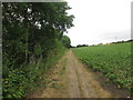
3
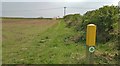
What's over there?
Hold camera up high above grassy bank and what do we see? Not a lot, but Edwinstowe beyond the field!
Image: © Chris Morgan
Taken: 7 May 2013
0.20 miles
4
Railway bridge crossing Mill Lane
Looking south west.
Image: © JThomas
Taken: 19 Mar 2015
0.22 miles
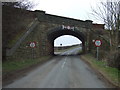
5
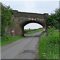
Edwinstowe: railway bridge over Mill Lane
The road leads to Clipstone. The bridge was built by the Lancashire, Derbyshire & East Coast Railway in the 1890s. Principally a coal carrier, the LD&ECR reached neither Lancashire nor the East Coast: its main line ran from Chesterfield (Market Place) to Lincoln.
Image: © John Sutton
Taken: 10 Jun 2019
0.22 miles
6
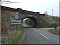
Entering Edwinstowe
Railway bridge crossing Mill Lane.
Image: © JThomas
Taken: 19 Mar 2015
0.22 miles
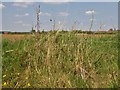
7
Robin Hood Way
Approaching a rail crossing.
Image: © Chris Morgan
Taken: 7 May 2013
0.23 miles
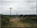
8
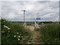
Crossing the line
Pedestrian crossing where the Robin Hood Way crosses the Lancashire, Derbyshire and East Coast Railway line.
Image: © Jonathan Thacker
Taken: 4 Jul 2014
0.23 miles
9
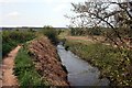
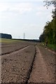
River Maun
The track is part of the Robin Hood Way trail.
Image: © Graham Hogg
Taken: 7 May 2013
0.23 miles
10
Bridleway crossing the railway west of Lidgett
Image: © John Slater
Taken: 22 Jul 2018
0.23 miles