IMAGES TAKEN NEAR TO
Mill Lane, MANSFIELD, NG21 9JN
Introduction
This page details the photographs taken nearby to Mill Lane, NG21 9JN by members of the Geograph project.
The Geograph project started in 2005 with the aim of publishing, organising and preserving representative images for every square kilometre of Great Britain, Ireland and the Isle of Man.

There are currently over 7.5m images from over14,400 individuals and you can help contribute to the project by visiting https://www.geograph.org.uk
Image Map
Images are licensed for reuse under creativecommons.org/licenses/by-sa/2.0
Notes
- Clicking on the map will re-center to the selected point.
- The higher the marker number, the further away the image location is from the centre of the postcode.
Image Listing (9 Images Found)
Images are licensed for reuse under creativecommons.org/licenses/by-sa/2.0
Image
Details
Distance
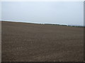
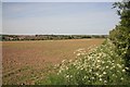
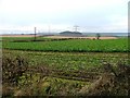
3
Eastfield hedgeline
Farmland near Edwinstowe
Image: © Richard Croft
Taken: 1 Feb 2012
0.16 miles
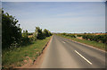
4
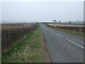
Minor road towards Edwinstowe
Heading north east.
Image: © JThomas
Taken: 19 Mar 2015
0.20 miles
5
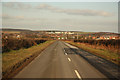
Edwinstowe Road
View towards Edwinstowe
Image: © Richard Croft
Taken: 1 Feb 2012
0.21 miles
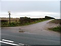
8
View North West From Entrance to Fir Tree Farm
My first photo submitted for this square was pretty boring so this is a shot about turn 180 degrees. Only slightly better.
Image: © Mick Garratt
Taken: 4 Dec 2005
0.24 miles