IMAGES TAKEN NEAR TO
Marklew Close, MANSFIELD, NG21 0PH
Introduction
This page details the photographs taken nearby to Marklew Close, NG21 0PH by members of the Geograph project.
The Geograph project started in 2005 with the aim of publishing, organising and preserving representative images for every square kilometre of Great Britain, Ireland and the Isle of Man.

There are currently over 7.5m images from over14,400 individuals and you can help contribute to the project by visiting https://www.geograph.org.uk
Image Map
Images are licensed for reuse under creativecommons.org/licenses/by-sa/2.0
Notes
- Clicking on the map will re-center to the selected point.
- The higher the marker number, the further away the image location is from the centre of the postcode.
Image Listing (29 Images Found)
Images are licensed for reuse under creativecommons.org/licenses/by-sa/2.0
Image
Details
Distance
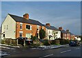
1
New Lane, Blidworth, Notts.
The 'civilisation' entry/departure point on New Lane, in to (or out of) Blidworth. This is part of the Robin Hood Trail route between Blidworth and Providence Farm, Blidworth.
Image: © David Hallam-Jones
Taken: 31 Dec 2014
0.04 miles
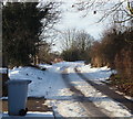
2
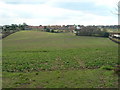
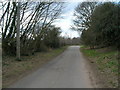
View of New Lane
A view west, up New Lane in Blidworth.
Image: © James Hill
Taken: 23 May 2007
0.05 miles
3
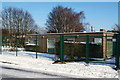
New Road, Blidworth, Notts.
These former Church Hall premises on New Road are now used by the Blidworth Army Cadet Corps Detachment. The library is situated obliquely opposite.
Image: © David Hallam-Jones
Taken: 31 Dec 2014
0.06 miles
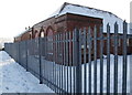
4
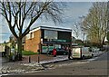
New Road, Blidworth, Notts.
Blidworth Library.
Image: © David Hallam-Jones
Taken: 31 Dec 2014
0.07 miles
7
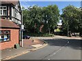
The eastern end of New Lane
Where it meets Mansfield Road.
Although New Lane to the west of here is no longer officially part of NCN Route 6 see Image The sign visible here is still accurate as there is a short section of Manfiled Road which has a segregated cycle path. It can be seen as the pale section of pavement on the left where it is (typically) blocked by a parked Audi.
Image: © David Lally
Taken: 31 Aug 2023
0.11 miles
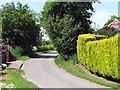
9
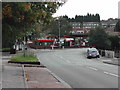
Blidworth Village
The junction of Mansfield Road and Dale Lane just off to the left, Main St up to the right. The famous Forest Folk Hotel stood on this corner off to the left.
Image: © Tom Courtney
Taken: 9 Oct 2005
0.13 miles