
IMAGES TAKEN NEAR TO
Ricket Lane, MANSFIELD, NG21 0NA
Introduction
This page details the photographs taken nearby to Ricket Lane, NG21 0NA by members of the Geograph project.
The Geograph project started in 2005 with the aim of publishing, organising and preserving representative images for every square kilometre of Great Britain, Ireland and the Isle of Man.

There are currently over 7.5m images from over14,400 individuals and you can help contribute to the project by visiting https://www.geograph.org.uk
Image Map
Images are licensed for reuse under creativecommons.org/licenses/by-sa/2.0
Notes
- Clicking on the map will re-center to the selected point.
- The higher the marker number, the further away the image location is from the centre of the postcode.
Image Listing (17 Images Found)
Images are licensed for reuse under creativecommons.org/licenses/by-sa/2.0
Image
Details
Distance
1
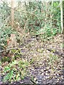
Friar Tuck's Well (wider view)
For further information, see Image
Image: © Antony Dixon
Taken: 27 Dec 2011
0.13 miles
2
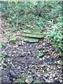
Friar Tuck's Well
This used to be a chalybeate spring, with a low wall and ornate iron railing (which have both gone). The water used to emerge from a pipe (visible as a dark patch near the top of the photo) and trickle down the step-like cascade in the centre. People used to come and take the water for its health-giving properties. Many colourful legends are associated with the area.
Sir Walter Scott stayed for a while at nearby Fountain Dale House while writing 'Ivanhoe' and based his description of Friar Tuck's domain on this spot.
It is thought to have been a holy well way back before Robin Hood's time, even possibly in pagan times. Unfortunately the site is now overgrown, broken down, very boggy and unattractive.
Image: © Antony Dixon
Taken: 27 Dec 2011
0.13 miles
3
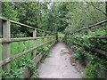
Unsafe boardwalk
There was a notice some distance to the east to say that this boardwalk was closed for repairs from 16th April to 6th May 2019. When I arrived here it was clear that no repairs had been done and at the far end was a notice saying the boardwalk would be closed until 15th October 2019. By then I had walked across it. It was a bit bouncy and I wouldn't want to cross on a horse but I have walked across far less stable bridges for which no repair notice has ever been given.
Image: © Jonathan Thacker
Taken: 21 Jul 2019
0.14 miles
4
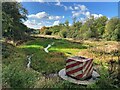
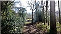
Lake near Friar Tuck's Well in Fountain Dale
Robin Hood tales and place name references abound across Nottinghamshire, Derbyshire and South Yorkshire, but you get a genuinely authentic sense of the legend in this particular valley.
Image: © Jonathan Clitheroe
Taken: 8 Oct 2022
0.14 miles
6
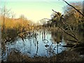
Lake in Fountain Dale
To my untrained eye, this looks like an environmental disaster. However, this is shown as a lake on the map, so I suppose those trees shouldn't have been growing there anyway . . .
Image: © Antony Dixon
Taken: 27 Dec 2011
0.16 miles
7
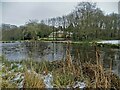
View to The Coach House, Fountain Dale
Image: © Neil Theasby
Taken: 30 Dec 2020
0.16 miles
8
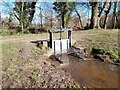
Sluice gate in the dam of a fish pond
Controlling the flow of water from the fish pond into Rainworth Water.
Image: © Ian Calderwood
Taken: 24 Feb 2024
0.16 miles
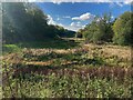
10
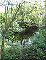
Fountain Dale Area, Ravenshead, Notts.
It seems that Friar Tuck (c. C15th) may have been one of a small number of hermits who dwelt in caves or cells near a holy well in this area. It seems that they may have been 'seconded' from nearby Newstead Priory and their remit – as curtal friars – was to act as the guardians of a small chapel containing a shrine, that “stood nearby, surrounded by a moat”. This small pond may have been a part of a circular or rectangular moat.
Image: © David Hallam-Jones
Taken: 10 Nov 2013
0.18 miles