
IMAGES TAKEN NEAR TO
Rufford Colliery Lane, MANSFIELD, NG21 0HR
Introduction
This page details the photographs taken nearby to Rufford Colliery Lane, NG21 0HR by members of the Geograph project.
The Geograph project started in 2005 with the aim of publishing, organising and preserving representative images for every square kilometre of Great Britain, Ireland and the Isle of Man.

There are currently over 7.5m images from over14,400 individuals and you can help contribute to the project by visiting https://www.geograph.org.uk
Image Map
Images are licensed for reuse under creativecommons.org/licenses/by-sa/2.0
Notes
- Clicking on the map will re-center to the selected point.
- The higher the marker number, the further away the image location is from the centre of the postcode.
Image Listing (10 Images Found)
Images are licensed for reuse under creativecommons.org/licenses/by-sa/2.0
Image
Details
Distance
1
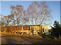
Cygnet, Sherwood Lodge
Cygnet Sherwood Lodge is a high dependency complex care service for men with learning disabilities.
Image: © Jonathan Thacker
Taken: 13 Jan 2022
0.04 miles
2
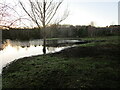
Flooded field off Rufford Colliery Lane
Image: © Jonathan Thacker
Taken: 13 Jan 2022
0.06 miles
3
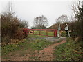
Entrance to Rainworth Heath Nature Reserve
Rainworth Heath is one of the last remaining areas of heathland in Nottinghamshire.
Image: © Jonathan Thacker
Taken: 17 Jan 2020
0.12 miles
4
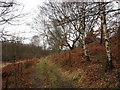
Track on Spring Hill
Part of Rainworth Heath Nature Reserve.
Image: © Jonathan Thacker
Taken: 17 Jan 2020
0.13 miles
5
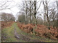
Path on Spring Hill
Part of the Rainworth Heath Nature Reserve.
Image: © Jonathan Thacker
Taken: 17 Jan 2020
0.16 miles
6
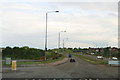
Rainworth bypass (A617)
Turn right for Rainworth.
Turn left for the sewage works and the former Rufford colliery coal-stocking yard and the sand quarry.
We had just crossed a disused railway and were about to cross another. For information on the railway network and the pits they served see http://www.railchronology.free-online.co.uk/East%20of%20Mansfield.htm
Image: © Chris
Taken: 13 May 2014
0.16 miles
7
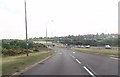
Minor road junction from A617
Minor road goes to Coal Disposal facility
Image: © John Firth
Taken: 9 Jun 2013
0.17 miles
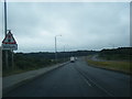
9
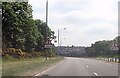
Bend on A617
Just south east of Rainworth Nurseries
Image: © John Firth
Taken: 9 Jun 2013
0.22 miles
10
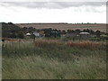
Sewage Treatment Plant
north of Rainworth Village
Image: © Tom Courtney
Taken: 9 Oct 2005
0.23 miles