IMAGES TAKEN NEAR TO
Kneesal Close, MANSFIELD, NG20 9QE
Introduction
This page details the photographs taken nearby to Kneesal Close, NG20 9QE by members of the Geograph project.
The Geograph project started in 2005 with the aim of publishing, organising and preserving representative images for every square kilometre of Great Britain, Ireland and the Isle of Man.

There are currently over 7.5m images from over14,400 individuals and you can help contribute to the project by visiting https://www.geograph.org.uk
Image Map
Images are licensed for reuse under creativecommons.org/licenses/by-sa/2.0
Notes
- Clicking on the map will re-center to the selected point.
- The higher the marker number, the further away the image location is from the centre of the postcode.
Image Listing (15 Images Found)
Images are licensed for reuse under creativecommons.org/licenses/by-sa/2.0
Image
Details
Distance
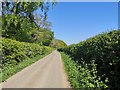
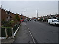
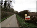
1
Netherfield Lane, Meden Vale
Heading west towards Church Warsop.
Image: © JThomas
Taken: 17 Mar 2014
0.07 miles
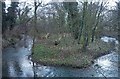
3
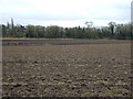
Ploughed field, Meden Vale
Off Netherfield Lane looking towards the River Meden.
Image: © JThomas
Taken: 17 Mar 2014
0.10 miles
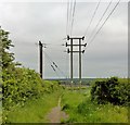
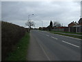
7
Carburton Avenue, Meden Vale
A very short cul de sac off Egmanton Road, leading to a public footpath that skirts the northern edge of the village.
Image: © Richard Vince
Taken: 25 Jun 2022
0.21 miles
8
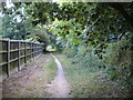
Public footpath behind Egmanton Road, Meden Vale (2)
Squeezed between back gardens and a strip of woodland.
Image: © Richard Vince
Taken: 25 Jun 2022
0.21 miles
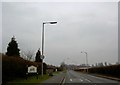
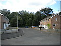
9
Roadway to Assarts Farm
A public bridleway.
Image: © Jonathan Thacker
Taken: 28 Jan 2022
0.23 miles