IMAGES TAKEN NEAR TO
Creswell Road, MANSFIELD, NG20 9NR
Introduction
This page details the photographs taken nearby to Creswell Road, NG20 9NR by members of the Geograph project.
The Geograph project started in 2005 with the aim of publishing, organising and preserving representative images for every square kilometre of Great Britain, Ireland and the Isle of Man.

There are currently over 7.5m images from over14,400 individuals and you can help contribute to the project by visiting https://www.geograph.org.uk
Image Map
Images are licensed for reuse under creativecommons.org/licenses/by-sa/2.0
Notes
- Clicking on the map will re-center to the selected point.
- The higher the marker number, the further away the image location is from the centre of the postcode.
Image Listing (8 Images Found)
Images are licensed for reuse under creativecommons.org/licenses/by-sa/2.0
Image
Details
Distance
2
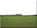
Tumulus near Cuckney
Photographed from lane to Blue Barn Farm. Looking towards Tumulus and Woodend house.
Image: © Anonymous
Taken: 2 Jan 2007
0.12 miles
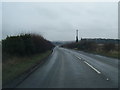
4
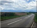
A616 Road Approaching Cuckney
Pictured from Woodend Farm.
Image: © Jonathan Clitheroe
Taken: 13 Apr 2022
0.17 miles
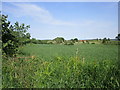
5
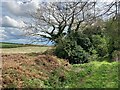
Byway and Fields near Holbeck
Having no real practical use these days the byway on the right is littered with the kind of detritus you'd expect in a secluded covert.
Image: © Jonathan Clitheroe
Taken: 13 Apr 2022
0.19 miles
6
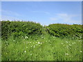
Steep rise to the road
A few steps are needed for this path to reach the road.
Image: © Jonathan Thacker
Taken: 26 May 2018
0.22 miles
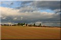
7
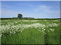
Overgrown path
A late spring has resulted in rapid growth of both grass and keck (cow parsley).
Image: © Jonathan Thacker
Taken: 26 May 2018
0.22 miles