IMAGES TAKEN NEAR TO
The Kennels, MANSFIELD, NG20 9LQ
Introduction
This page details the photographs taken nearby to The Kennels, NG20 9LQ by members of the Geograph project.
The Geograph project started in 2005 with the aim of publishing, organising and preserving representative images for every square kilometre of Great Britain, Ireland and the Isle of Man.

There are currently over 7.5m images from over14,400 individuals and you can help contribute to the project by visiting https://www.geograph.org.uk
Image Map
Images are licensed for reuse under creativecommons.org/licenses/by-sa/2.0
Notes
- Clicking on the map will re-center to the selected point.
- The higher the marker number, the further away the image location is from the centre of the postcode.
Image Listing (13 Images Found)
Images are licensed for reuse under creativecommons.org/licenses/by-sa/2.0
Image
Details
Distance
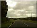
2
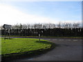
Infield Lane - Junction with the Worksop Road (A60)
Image: © Alan Heardman
Taken: 15 Nov 2008
0.06 miles
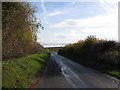
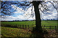
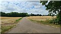
4
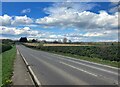
A60 Road Between Cuckney and Holbeck
Image: © Jonathan Clitheroe
Taken: 13 Apr 2022
0.13 miles
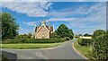
7
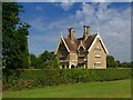
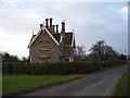
South Park Lodge
One of many cottages on the Welbeck Estate built to this design
Image: © Graham Hogg
Taken: 22 Aug 2022
0.18 miles