IMAGES TAKEN NEAR TO
Arlington Avenue, MANSFIELD, NG19 9DH
Introduction
This page details the photographs taken nearby to Arlington Avenue, NG19 9DH by members of the Geograph project.
The Geograph project started in 2005 with the aim of publishing, organising and preserving representative images for every square kilometre of Great Britain, Ireland and the Isle of Man.

There are currently over 7.5m images from over14,400 individuals and you can help contribute to the project by visiting https://www.geograph.org.uk
Image Map
Images are licensed for reuse under creativecommons.org/licenses/by-sa/2.0
Notes
- Clicking on the map will re-center to the selected point.
- The higher the marker number, the further away the image location is from the centre of the postcode.
Image Listing (11 Images Found)
Images are licensed for reuse under creativecommons.org/licenses/by-sa/2.0
Image
Details
Distance
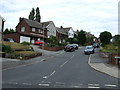
1
Windermere Close, New Hill Lane
Mansfield Woodhouse.
Image: © Ian S
Taken: 8 Oct 2016
0.16 miles
3
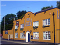
The Loxley, Leeming Lane North
One of the many establishments licensed to serve intoxicating beverages in the Mansfield area!
Image: © James Hill
Taken: 20 May 2007
0.17 miles
4
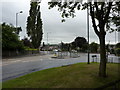
Traffic lights at road junction
On Peafield Lane (the A6075),looking towards Leeming Lane North (the A60).
Image: © Peter Barr
Taken: 16 Aug 2013
0.20 miles
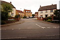
6
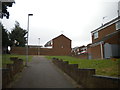
Footpath off Peafield Lane, Mansfield Woodhouse
Leading to Brackenfield Avenue.
Image: © Richard Vince
Taken: 15 Aug 2020
0.20 miles
7
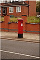
Edward VII postbox
On New Mill Lane, Mansfield Woodhouse.
Image: © Ian S
Taken: 8 Oct 2016
0.21 miles
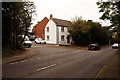
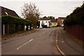
8
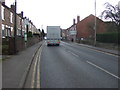
Leeming Lane South (A60)
Heading towards Mansfield.
Image: © JThomas
Taken: 16 Mar 2014
0.22 miles
9
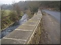
River Maun, New Mill Lane, Mansfield
View towards Clipstone, where river flows under New Mill Lane.
Image: © Geoff Dunn
Taken: 3 Feb 2006
0.22 miles