IMAGES TAKEN NEAR TO
Clover Way, MANSFIELD, NG19 9BF
Introduction
This page details the photographs taken nearby to Clover Way, NG19 9BF by members of the Geograph project.
The Geograph project started in 2005 with the aim of publishing, organising and preserving representative images for every square kilometre of Great Britain, Ireland and the Isle of Man.

There are currently over 7.5m images from over14,400 individuals and you can help contribute to the project by visiting https://www.geograph.org.uk
Image Map
Images are licensed for reuse under creativecommons.org/licenses/by-sa/2.0
Notes
- Clicking on the map will re-center to the selected point.
- The higher the marker number, the further away the image location is from the centre of the postcode.
Image Listing (10 Images Found)
Images are licensed for reuse under creativecommons.org/licenses/by-sa/2.0
Image
Details
Distance
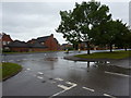
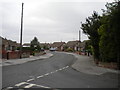
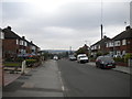
2
Dennor Drive, Mansfield Woodhouse
Off Peafield Lane.
Image: © Richard Vince
Taken: 15 Aug 2020
0.06 miles
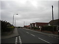
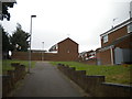
3
Footpath alongside Litton Road, Mansfield Woodhouse
Image: © Richard Vince
Taken: 15 Aug 2020
0.12 miles
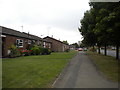
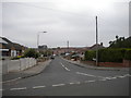
4
Marples Avenue, Mansfield Woodhouse (2)
From the junction with Dennor Drive.
Image: © Richard Vince
Taken: 15 Aug 2020
0.14 miles
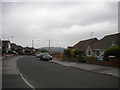
5
Marples Avenue, Mansfield Woodhouse (1)
From the junction with Dennor Drive.
Image: © Richard Vince
Taken: 15 Aug 2020
0.15 miles
6
Footpath off Peafield Lane, Mansfield Woodhouse
Leading to Brackenfield Avenue.
Image: © Richard Vince
Taken: 15 Aug 2020
0.22 miles
7
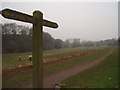
Maun Valley Trail, Mansfield
View from New Mill Lane, towards Old Mill Lane
Image: © Geoff Dunn
Taken: 3 Feb 2006
0.22 miles
8
West end of Wheatfield Crescent, Mansfield Woodhouse
Off Marples Avenue.
Image: © Richard Vince
Taken: 15 Aug 2020
0.23 miles
9
Marples Avenue, Mansfield Woodhouse (3)
From the junction with Wheatfield Crescent.
Image: © Richard Vince
Taken: 15 Aug 2020
0.24 miles
10
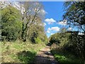
Bridleway by the River Maun
Trail following the course of the river which is out of picture to the right.
Image: © Jonathan Clitheroe
Taken: 8 Apr 2022
0.25 miles