IMAGES TAKEN NEAR TO
Cedar Avenue, MANSFIELD, NG19 8NQ
Introduction
This page details the photographs taken nearby to Cedar Avenue, NG19 8NQ by members of the Geograph project.
The Geograph project started in 2005 with the aim of publishing, organising and preserving representative images for every square kilometre of Great Britain, Ireland and the Isle of Man.

There are currently over 7.5m images from over14,400 individuals and you can help contribute to the project by visiting https://www.geograph.org.uk
Image Map
Images are licensed for reuse under creativecommons.org/licenses/by-sa/2.0
Notes
- Clicking on the map will re-center to the selected point.
- The higher the marker number, the further away the image location is from the centre of the postcode.
Image Listing (10 Images Found)
Images are licensed for reuse under creativecommons.org/licenses/by-sa/2.0
Image
Details
Distance
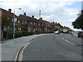
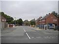
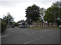
2
Park Hall Road, Mansfield Woodhouse
Heading north.
Image: © JThomas
Taken: 7 Sep 2013
0.11 miles
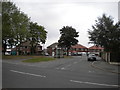
3
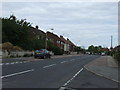
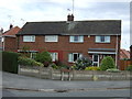
Beech Tree Avenue, Mansfield Woodhouse
Heading south.
Image: © JThomas
Taken: 7 Sep 2013
0.11 miles
4
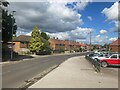
Beech Tree Avenue in Mansfield Woodhouse
Image: © Jonathan Clitheroe
Taken: 30 Aug 2023
0.12 miles
7
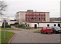
Manor Comprehensive School, Mansfield Woodhouse
Upon Park Hall Road Mansfield Woodhouse
Image: © Geoff Dunn
Taken: 12 Feb 2006
0.15 miles
8
Chestnut Grove, Mansfield Woodhouse
Off Beech Tree Avenue.
Image: © Richard Vince
Taken: 15 Aug 2020
0.20 miles
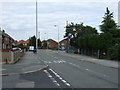
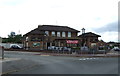
9
Bus stop off Park Hall Road, Mansfield Woodhouse
In the triangular junction with Beech Tree Avenue, with Stagecoach Mansfield 22777, an MAN 18.240/Alexander Dennis Enviro 300, in attendance. On the right is an additional bus only lane, which appears to be there to enable buses going away from the camera to stop on the opposite side of the same shelter as the bus shown here. However, Stagecoach Mansfield route 1 serves this area with a one way loop, so the bus lane appears to be little used.
Image: © Richard Vince
Taken: 15 Aug 2020
0.20 miles
10
Bus stop off Beech Tree Avenue, Mansfield Woodhouse
In the triangular junction with Park Hall Road. On the left is an additional bus only lane, which appears to be there to enable buses coming towards the camera to stop on the opposite side of the same shelter as those going away from the camera. However, Stagecoach Mansfield route 1 serves this area with a one way loop, so the bus lane appears to be little used.
Image: © Richard Vince
Taken: 15 Aug 2020
0.20 miles