IMAGES TAKEN NEAR TO
Cambria Road, MANSFIELD, NG19 7RJ
Introduction
This page details the photographs taken nearby to Cambria Road, NG19 7RJ by members of the Geograph project.
The Geograph project started in 2005 with the aim of publishing, organising and preserving representative images for every square kilometre of Great Britain, Ireland and the Isle of Man.

There are currently over 7.5m images from over14,400 individuals and you can help contribute to the project by visiting https://www.geograph.org.uk
Image Map
Images are licensed for reuse under creativecommons.org/licenses/by-sa/2.0
Notes
- Clicking on the map will re-center to the selected point.
- The higher the marker number, the further away the image location is from the centre of the postcode.
Image Listing (10 Images Found)
Images are licensed for reuse under creativecommons.org/licenses/by-sa/2.0
Image
Details
Distance
1
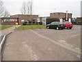
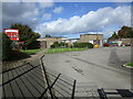
Farmilo Primary School and Nursery
Upon Woburn Road, Pleasley, Mansfield
Image: © Geoff Dunn
Taken: 12 Feb 2006
0.09 miles
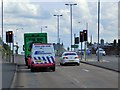
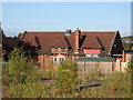
4
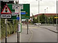
Houses on Chesterfield Road North, Radmanthwaite
Image: © Ian S
Taken: 8 Oct 2016
0.16 miles
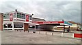
7
Pleasley - old school
This school on Pleasley Hill is now a timber merchants.
Image: © Dave Bevis
Taken: 8 Oct 2009
0.17 miles
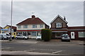
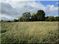
8
Track from Radmanthwaite Road
A track that leads off Radmanthwaite Road.
Image: © James Hill
Taken: 9 Sep 2007
0.19 miles
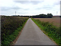
10
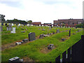
Pleasley Cemetery
The cemetery at Pleasley.
Image: © James Hill
Taken: 9 Sep 2007
0.22 miles