IMAGES TAKEN NEAR TO
Haddon Road, MANSFIELD, NG19 7BS
Introduction
This page details the photographs taken nearby to Haddon Road, NG19 7BS by members of the Geograph project.
The Geograph project started in 2005 with the aim of publishing, organising and preserving representative images for every square kilometre of Great Britain, Ireland and the Isle of Man.

There are currently over 7.5m images from over14,400 individuals and you can help contribute to the project by visiting https://www.geograph.org.uk
Image Map
Images are licensed for reuse under creativecommons.org/licenses/by-sa/2.0
Notes
- Clicking on the map will re-center to the selected point.
- The higher the marker number, the further away the image location is from the centre of the postcode.
Image Listing (11 Images Found)
Images are licensed for reuse under creativecommons.org/licenses/by-sa/2.0
Image
Details
Distance
1
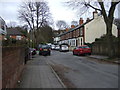
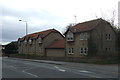
Edgar Avenue
Heading east off Woodhouse Road.
Image: © JThomas
Taken: 16 Mar 2014
0.12 miles
3
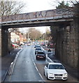
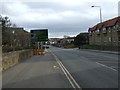
Leeming Lane South, Mansfield Woodhouse, Notts.
Leeming Lane South, i.e. the A60, is visible ahead in the Market Warsop direction. This bridge carries trains between Mansfield and Mansfield Woodhouse stations. The section of the A60 on this side of the bridge is Mansfield Road.
Image: © David Hallam-Jones
Taken: 23 Jan 2016
0.16 miles
4
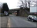
Railway bridge over Leeming Lane South (A60)
Heading south towards Mansfield.
Image: © JThomas
Taken: 16 Mar 2014
0.17 miles
5
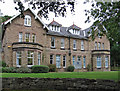
Mansfield - Eden Court on Crow Hill Drive
Image: © Dave Bevis
Taken: 17 Sep 2013
0.19 miles
7
Woodhouse Road (A60), Mansfield
Heading south.
Image: © JThomas
Taken: 16 Mar 2014
0.21 miles
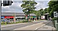
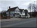
8
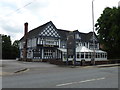
The Black Bull
Large pub on Woodhouse Road to the north of the town centre
Image: © Graham Hogg
Taken: 2 Jun 2014
0.22 miles
10
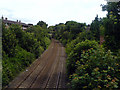
Robin Hood Line, Mansfield
The Robin Hood Line as it passes beneath the bridge next to Carr Bank Park in Mansfield.
Image: © James Hill
Taken: 2 Jul 2007
0.23 miles