IMAGES TAKEN NEAR TO
Abbott Road, MANSFIELD, NG19 6LX
Introduction
This page details the photographs taken nearby to Abbott Road, NG19 6LX by members of the Geograph project.
The Geograph project started in 2005 with the aim of publishing, organising and preserving representative images for every square kilometre of Great Britain, Ireland and the Isle of Man.

There are currently over 7.5m images from over14,400 individuals and you can help contribute to the project by visiting https://www.geograph.org.uk
Image Map
Images are licensed for reuse under creativecommons.org/licenses/by-sa/2.0
Notes
- Clicking on the map will re-center to the selected point.
- The higher the marker number, the further away the image location is from the centre of the postcode.
Image Listing (13 Images Found)
Images are licensed for reuse under creativecommons.org/licenses/by-sa/2.0
Image
Details
Distance
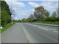
1
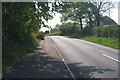
Brick Kiln Lane
Looking up Brick Kiln Lane from its junction with Abbott Road.
Image: © Ann B
Taken: 12 May 2006
0.03 miles
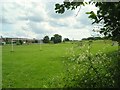
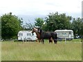
2
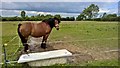
En suite field with bath, suitable for horse play
Image: © Chris Morgan
Taken: 12 Jun 2017
0.07 miles
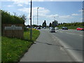
3
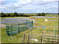
Covered reservoirs next to A6075
A couple of covered reservoirs next to the A6075 in Mansfield.
Image: © James Hill
Taken: 26 Aug 2007
0.08 miles
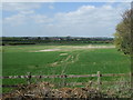
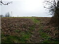
7
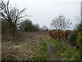
Path and waste ground off Cumberland Drive
Image: © Jonathan Thacker
Taken: 29 Feb 2024
0.15 miles