IMAGES TAKEN NEAR TO
Kaye Road, MANSFIELD, NG19 6JP
Introduction
This page details the photographs taken nearby to Kaye Road, NG19 6JP by members of the Geograph project.
The Geograph project started in 2005 with the aim of publishing, organising and preserving representative images for every square kilometre of Great Britain, Ireland and the Isle of Man.

There are currently over 7.5m images from over14,400 individuals and you can help contribute to the project by visiting https://www.geograph.org.uk
Image Map
Images are licensed for reuse under creativecommons.org/licenses/by-sa/2.0
Notes
- Clicking on the map will re-center to the selected point.
- The higher the marker number, the further away the image location is from the centre of the postcode.
Image Listing (8 Images Found)
Images are licensed for reuse under creativecommons.org/licenses/by-sa/2.0
Image
Details
Distance
2
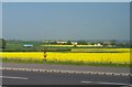
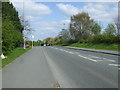
Oil seed rape field
Field at the side of Abbott Road opposite the junction with Brick Kiln Lane. Traffic can be seen on the new MARR road (Mansfield and Ashfield Regeneration Route).
Image: © Ann B
Taken: 12 May 2006
0.12 miles
3

Outside the Flying High Academy
A newly built primary school proud of its first Ofsted report.
Image: © Graham Hogg
Taken: 12 Jun 2017
0.16 miles
4
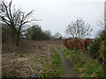
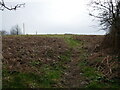
Path and waste ground off Cumberland Drive
Image: © Jonathan Thacker
Taken: 29 Feb 2024
0.19 miles
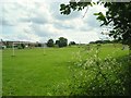
7
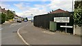
To the football club changing rooms down Birks Road
Image: © Chris Morgan
Taken: 12 Jun 2017
0.23 miles