
IMAGES TAKEN NEAR TO
Radford Street, MANSFIELD, NG18 5TB
Introduction
This page details the photographs taken nearby to Radford Street, NG18 5TB by members of the Geograph project.
The Geograph project started in 2005 with the aim of publishing, organising and preserving representative images for every square kilometre of Great Britain, Ireland and the Isle of Man.

There are currently over 7.5m images from over14,400 individuals and you can help contribute to the project by visiting https://www.geograph.org.uk
Image Map
Images are licensed for reuse under creativecommons.org/licenses/by-sa/2.0
Notes
- Clicking on the map will re-center to the selected point.
- The higher the marker number, the further away the image location is from the centre of the postcode.
Image Listing (244 Images Found)
Images are licensed for reuse under creativecommons.org/licenses/by-sa/2.0
Image
Details
Distance
1
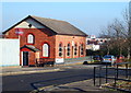
Radford Street, Mansfield, Notts.
Mansfield's Gospel Hall. The site of the former bus station can be glimpsed behind it and a modern shopping complex behind that. Both of the latter are situated on the town centre side of the A38.
Image: © David Hallam-Jones
Taken: 20 Jan 2016
0.02 miles
2
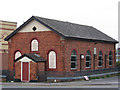
Mansfield - Gospel Hall
On Radford Street.
Image: © Dave Bevis
Taken: 14 Apr 2011
0.02 miles
3
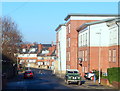
Dallas Street, Mansfield, Notts.
Dallas Street is seen here the approach to its T junction with the busy A38 (a.k.a. Stockwell Gate).
Image: © David Hallam-Jones
Taken: 20 Jan 2016
0.04 miles
4
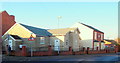
Dallas Street, Mansfield, Notts.
Dallas Street curves round from the left, passes this Spiritualist Church, and within a minute's walk joins the busy A38 (a.k.a. Stockwell Gate) at a T junction.
Image: © David Hallam-Jones
Taken: 20 Jan 2016
0.04 miles
5
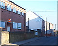
Victoria Street, Mansfield, Notts.
Victoria Street, looking towards Rooth Street. Victoria Street is home, amongst other businesses, to the Victoria Antiques and Collectables Centre.
Image: © David Hallam-Jones
Taken: 20 Jan 2016
0.07 miles
6
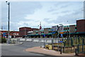
Former Bus Station, Mansfield, Notts.
The former bus station, off Rosemary Street (the A6009), opened on 20th November 1977 and closed on 30 March 2013 when it was replaced by a new one on Quaker Way that has a covered link to the railway station. Some consideration has already being given to a large part of the bus station being developed as an extension to the neighbouring Four Seasons shopping centre. Unfortunately however, Mansfield already has a glut of vacant shops.
Image: © David Hallam-Jones
Taken: 16 Jun 2013
0.07 miles
7
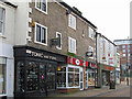
Mansfield - shops on south side of Stockwell Gate
Image: © Dave Bevis
Taken: 12 Feb 2016
0.07 miles
8
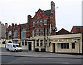
Mansfield - The Red
Properly called the Red Lion. On Stockwell Gate.
Image: © Dave Bevis
Taken: 14 Apr 2011
0.08 miles
9
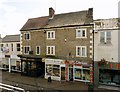
53 ? 57 Stockwell Gate, Mansfield
Formerly 3 houses, mid 18th century, with later shops added. Listed Grade II.
Image: © Alan Murray-Rust
Taken: 21 Aug 2019
0.08 miles
10
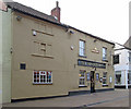
Mansfield - The Wheatsheaf
Pub on Stockwell Gate. For an alternative view, please see Image
Image: © Dave Bevis
Taken: 12 Feb 2016
0.08 miles