IMAGES TAKEN NEAR TO
Maple Drive, MANSFIELD, NG18 4UY
Introduction
This page details the photographs taken nearby to Maple Drive, NG18 4UY by members of the Geograph project.
The Geograph project started in 2005 with the aim of publishing, organising and preserving representative images for every square kilometre of Great Britain, Ireland and the Isle of Man.

There are currently over 7.5m images from over14,400 individuals and you can help contribute to the project by visiting https://www.geograph.org.uk
Image Map
Images are licensed for reuse under creativecommons.org/licenses/by-sa/2.0
Notes
- Clicking on the map will re-center to the selected point.
- The higher the marker number, the further away the image location is from the centre of the postcode.
Image Listing (26 Images Found)
Images are licensed for reuse under creativecommons.org/licenses/by-sa/2.0
Image
Details
Distance
1
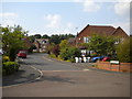
Poplars Way, Harlow Wood
Off Oak View Rise.
Image: © Richard Vince
Taken: 14 Jul 2018
0.04 miles
2
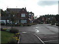
Harlow Wood, private housing estate
Built on the old site of Harlow Wood Hospital.
Image: © Tom Courtney
Taken: 25 Sep 2005
0.06 miles
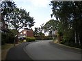
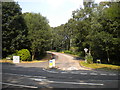
4
Eastern part of Oak View Rise, Harlow Wood
At the junction with Lime Tree Drive.
Image: © Richard Vince
Taken: 14 Jul 2018
0.09 miles
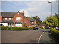
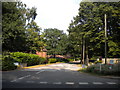
5
West end of Oak View Rise, Harlow Wood
Seen from the A60.
Image: © Richard Vince
Taken: 14 Jul 2018
0.11 miles
6
Private road off the A60, Harlow Wood
Image: © Richard Vince
Taken: 14 Jul 2018
0.12 miles
7
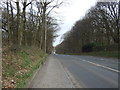
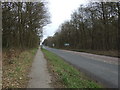
Nottingham Road (A60)
Heading north towards Mansfield.
Image: © JThomas
Taken: 17 Mar 2014
0.14 miles
8
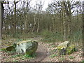
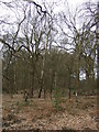
Path into Thieves' Wood
Looking west from the A60.
Image: © JThomas
Taken: 17 Mar 2014
0.14 miles
10
Thieves' Wood
Off the A60 near Fountaindale School.
Image: © JThomas
Taken: 17 Mar 2014
0.21 miles