
IMAGES TAKEN NEAR TO
Lindhurst, MANSFIELD, NG18 4TF
Introduction
This page details the photographs taken nearby to Lindhurst, NG18 4TF by members of the Geograph project.
The Geograph project started in 2005 with the aim of publishing, organising and preserving representative images for every square kilometre of Great Britain, Ireland and the Isle of Man.

There are currently over 7.5m images from over14,400 individuals and you can help contribute to the project by visiting https://www.geograph.org.uk
Image Map
Images are licensed for reuse under creativecommons.org/licenses/by-sa/2.0
Notes
- Clicking on the map will re-center to the selected point.
- The higher the marker number, the further away the image location is from the centre of the postcode.
Image Listing (5 Images Found)
Images are licensed for reuse under creativecommons.org/licenses/by-sa/2.0
Image
Details
Distance
1
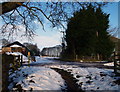
Lindhurst Farm, South of Mansfield, Notts.
The northern-most section of Lindhurst Lane can be seen in the distance disappearing to where it joins the A617 (10-15 minutes walk away). The low building on the left belongs to the Lindhurst Farm & Livery complex. On the right, passing in front of the taller, green-painted building, the track leads to Blidworth Lane. A set of secured gates however, now prevent pedestrian or vehicular access to Blidworth Lane due to the existence of the wind farm through which it passes. Walkers can reach Providence Farm, Blidworth within 10 minutes (approx.) by taking the footpath behind the photographer.
Image: © David Hallam-Jones
Taken: 31 Dec 2014
0.12 miles
2
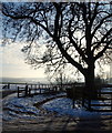
Lindhurst Farm, South of Mansfield, Notts.
Walking from here to Providence Farm, Blidworth (ahead) takes approximately 15-20 minutes. Alternatively, walkers can reach the A617 road by joining Lindhurst Lane half a dozen paces away behind the photographer.
Image: © David Hallam-Jones
Taken: 31 Dec 2014
0.12 miles
3
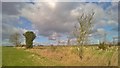
View towards Lindhurst Farm and Cottages
Image: © Chris Morgan
Taken: 22 Feb 2016
0.16 miles
4
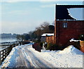
Lindhurst Farm, South of Mansfield, Notts.
Lindhurst Farm at the side of a track connecting The Spinney housing development - off the main Nottingham-Mansfield road (A60) - with Lindhurst Lane. Mansfield Road is 30 minutes walk ahead. This 'farm' also offers livery facilities. Blidworth Lane can be accessed a few paces away behind the photographer.
Image: © David Hallam-Jones
Taken: 31 Dec 2014
0.16 miles
5
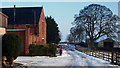
Lindhurst Farm, South of Mansfield, Notts.
Lindhurst Farm seen at the side of the track connecting The Spinney housing development - off the main Nottingham-Mansfield road (A60)- with Lindhurst Lane. Mansfield Road is 30 minutes walk away, behind the photographer. This 'farm' also offers livery facilities. The track ahead (beyond the gates) leads to Blidworth Lane but it is now gated at both ends, due perhaps to the existence of a large wind farm on the land between these two points?
Image: © David Hallam-Jones
Taken: 31 Dec 2014
0.17 miles