IMAGES TAKEN NEAR TO
Warwick Drive, MANSFIELD, NG18 3AE
Introduction
This page details the photographs taken nearby to Warwick Drive, NG18 3AE by members of the Geograph project.
The Geograph project started in 2005 with the aim of publishing, organising and preserving representative images for every square kilometre of Great Britain, Ireland and the Isle of Man.

There are currently over 7.5m images from over14,400 individuals and you can help contribute to the project by visiting https://www.geograph.org.uk
Image Map
Images are licensed for reuse under creativecommons.org/licenses/by-sa/2.0
Notes
- Clicking on the map will re-center to the selected point.
- The higher the marker number, the further away the image location is from the centre of the postcode.
Image Listing (14 Images Found)
Images are licensed for reuse under creativecommons.org/licenses/by-sa/2.0
Image
Details
Distance
1
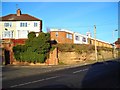
A house built upon rock
Exposed rock on the corner of Shaw Street and Pecks Hill. I believe this is Bunter sandstone, but I'm not a geologist, so don't take my word for it . . .
Image: © Antony Dixon
Taken: 16 Jan 2012
0.17 miles
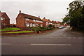
3
Bungalows at the Patchills
Located to the east of Mansfield Town Centre.
Image: © Jonathan Clitheroe
Taken: 8 Oct 2022
0.19 miles
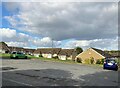
4
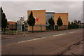
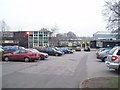
The Samworth Church Academy, Ravensdale
Image: © Jonathan Thacker
Taken: 13 Jan 2022
0.19 miles
5
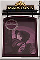
The Ravensdale, Sherwood Hall Road, Mansfield
http://www.geograph.org.uk/photo/5155960
Image: © Ian S
Taken: 8 Oct 2016
0.21 miles
7
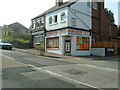
Kirkham Car Parts on Skerry Hill
http://kirkhamcarparts.co.uk
Image: © Neil
Taken: 31 Jul 2004
0.22 miles
8
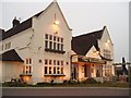
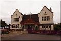
The Ravensdale Public House, Mansfield
Standing at the junction of Ravensdale Road and Sherwood Hall Road
Image: © Geoff Dunn
Taken: 2 Feb 2006
0.22 miles
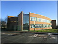
9
Sherwood Hall Comprehensive School, Mansfield
Upon Sherwood Hall Road, Mansfield
Image: © Geoff Dunn
Taken: 2 Feb 2006
0.22 miles
10
The Ravensdale, Sherwood Hall Road, Mansfield
http://www.geograph.org.uk/photo/5155964
Image: © Ian S
Taken: 8 Oct 2016
0.22 miles