1
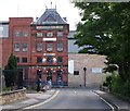
Littleworth and Baums Lane
Dominated by the back of the Nottinghamshire County Council offices.
Image: © David Lally
Taken: 22 Mar 2010
0.10 miles
2
Performance space, Titchfield Park, Mansfield
On the site of a paddling pool which had the same semicircular shape. The park originally had a bandstand, but maps show that this had disappeared by the 1950s.
Image: © Alan Murray-Rust
Taken: 21 Aug 2019
0.11 miles
3
Mansfield Brewery demolition
Demolition of the old Mansfield Brewery site continues. The site closed in December 2001 after providing intoxicating beverages for over 145 years.
Image: © James Hill
Taken: 26 Aug 2007
0.12 miles
4
Space for a brewery
Part of the old Mansfield Brewery site.
Image: © David Lally
Taken: 22 Mar 2010
0.12 miles
5
Mansfield - Brewery HQ
Image: © Dave Bevis
Taken: 12 Apr 2004
0.13 miles
6
Former Mansfield Brewery
The old brewery tower, with original signage. The Discovery Centre closed in 2015.
Image: © Alan Murray-Rust
Taken: 21 Aug 2019
0.13 miles
7
Former Mansfield Brewery
Some of the buildings have been converted for further use, but much is still awaiting redevelopment.
Image: © Alan Murray-Rust
Taken: 21 Aug 2019
0.13 miles
8
Brunt Street
With the remnants of the Mansfield Brewery buildings on the right.
Image: © David Lally
Taken: 22 Mar 2010
0.13 miles
9
Titchfield Park, Mansfield
A lovely "green space" in Mansfield that has seen a recent revamp and a Green Flag award. The only fault I can pick is that the huge concrete pipes and old blue tractor that I spent many happy hours playing in and on as a child have been removed. Still, I doubt that they would have gone with the current scheme.
Image: © James Hill
Taken: 26 Aug 2007
0.14 miles
10
Mansfield, Notts (Littleworth)
A discovery centre called "Making It" is now housed here in the former home of the Mansfield Brewery Company on this section of Littleworth, at its junction with Bath Street. It was constructed in 1855 on land that was once a part of the North Notts Coalfield although an additional site was opened later - elsewhere in the town - due to the need for larger and more modern premises. As a consequence of this, this site was closed in the late 70s. The main beer brewed here was Mansfield Bitter. In 1999, after the company was taken over by Wolverhampton & Dudley Breweries (now Marstons), the production of Mansfield Bitter was transferred to Wolverhampton. The water used there however, led to the production of a very different tasting beer and one that "Mansfield" drinkers weren't happy with, thus the demand for Mansfield bitter fell drastically, at least in its home town.
Image: © David Hallam-Jones
Taken: 15 Jul 2012
0.14 miles


