1
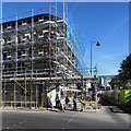
20 Carrington Street, Nottingham
Built in 1913 to the designs of the architect Frank Ketton.
Image: © Andrew Abbott
Taken: 25 May 2020
0.00 miles
2
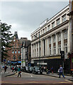
Nottingham Station Exit
Image: © Andy Jamieson
Taken: 21 Mar 2008
0.01 miles
3
Carrington Street
As can be seen from the state of the lights, the bus I was on was about to set-off.
The line of businesses on the left opposite the Broadmarsh bus station have not been doing very well in the last few years and many have closed. This spot has never been the most inspiring in Nottingham, but is now looking decidedly run-down.
Image: © David Lally
Taken: 27 Mar 2010
0.01 miles
4
Junction of Carrington Street and Canal Street, Nottingham
Image: © Andrew Abbott
Taken: 6 Apr 2010
0.01 miles
5
Scaffolding on Carrington Street
Following the demolition of the Broad Marsh bus station and car park (behind the green boarding on the right), the area is having a much-needed face-lift. Pedestrians are waiting to cross Canal Street.
Image: © John Sutton
Taken: 26 Jun 2018
0.01 miles
6
Broad Marsh car park and bus station, ready for demolition
The area is being completely redeveloped with an increase in pedestrianised areas leading up to the railway station. Bus stands for services which used the bus station have been distributed around the area.
Image: © Alan Murray-Rust
Taken: 3 Sep 2017
0.01 miles
7
Carrington Street
In the course of being transformed into a pedestrianised area as part of the redevelopment of the Broad Marsh area. On the right the new Central Library, in the background the partly demolished Broad Marsh Centre.
Image: © Alan Murray-Rust
Taken: 30 Apr 2021
0.01 miles
8
6-12 Carrington Street, Nottingham
What looks like it might have begun life as quite a grand department store between the wars now fallen on slightly hard times.
It was partly occupied by Bhatia Best Solicitors.
Image: © Stephen Richards
Taken: 19 Jun 2015
0.02 miles
9
Upstairs Showroom Now (not) Open
The shop on this corner (of Canal Street and Carrington Street) has been closed for over seven years
Image: © David Lally
Taken: 17 Apr 2017
0.02 miles
10
22 Carrington Street, Nottingham
Built in 1923 by the architects Bromley and Watkins for the Anglo-American Oil Company as a filling station.
Image: © Andrew Abbott
Taken: 25 May 2020
0.02 miles


